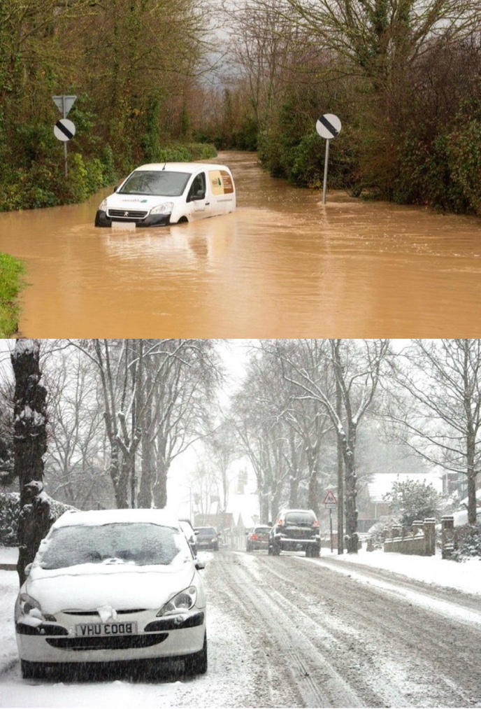
A spell of wintry weather is set to sweep across large parts of the country this weekend, with heavy snow predicted in parts of the South West and a cold health alert now in force.
The alert, issued by the UK Health Security Agency (UKHSA), runs from 6am on Friday until 8am on Monday. It covers the South West, the Midlands, the North East, the North West, and Yorkshire and The Humber. The agency warned that the drop in temperatures is likely to pose “a greater risk to life of vulnerable people” and could lead to increased pressure on healthcare services.
Health officials are urging people to check in on elderly neighbours and relatives, ensure homes are adequately heated, and take extra care when travelling in icy conditions. Cold weather can significantly worsen existing health conditions, particularly for older people, those with respiratory illnesses, and individuals experiencing fuel poverty.
The warning comes as the Met Office has issued a yellow weather warning for snow affecting parts of Wales and central England on Wednesday and Thursday. Forecasters say snowfall could lead to travel disruption, including hazardous driving conditions and possible delays to rail services.
In addition, a separate yellow warning for heavy rain is in place for southern England across the same period, with the risk of localised flooding and further disruption to road and rail networks. Commuters are being advised to monitor local forecasts closely and allow extra time for journeys.
The renewed threat of snow follows weeks of exceptionally wet weather. According to the UK Centre for Ecology and Hydrology (UKCEH), rivers across the south and southwest of England reached exceptionally high levels in January, with some breaking long-standing records. The persistent rainfall since the start of 2026 has left ground conditions dangerously saturated.
In some of the worst-affected areas, the soil is so waterlogged that groundwater is now rising to the surface. This phenomenon can trigger sudden and unpredictable flooding, even in locations not typically considered high-risk. Experts warn that with the water table already elevated, it will take sustained dry conditions for river levels and groundwater to return to normal.
The Environment Agency has also warned of a significant risk of groundwater flooding that could persist for months. Unlike flash flooding, groundwater flooding can develop more slowly but last considerably longer, affecting homes, roads and farmland over extended periods.
The UK could face an increased flood risk for months to come due to the sheer volume of rain that has already fallen this year. The combination of saturated soils, high river levels and further heavy rain creates what experts describe as a “compounding risk” scenario.
The arrival of snow on top of these already fragile conditions adds further complexity. Rapid thawing after snowfall can exacerbate flooding, as meltwater runs off quickly over saturated ground, feeding into already swollen rivers and drainage systems.
Local authorities across the Southwest are expected to deploy gritters and activate winter response plans as temperatures drop. Residents are being urged to prepare by stocking up on essentials, checking heating systems are working properly, and ensuring vulnerable neighbours are supported.
While yellow warnings do not necessarily mean severe impacts are guaranteed, they do signal the potential for disruption. Forecasters stress that weather conditions can change rapidly, particularly during cold snaps, and even relatively small amounts of snow can cause significant problems in areas unaccustomed to sustained wintry weather.
As the weekend approaches, the message from health officials and weather experts alike is clear: stay informed, take sensible precautions, and be prepared for challenging conditions.


