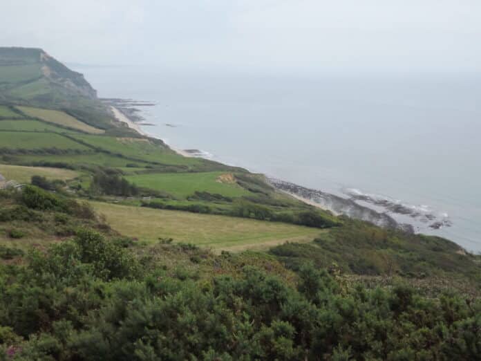
In the coastal section from Golden Cap to Charmouth clay rocks again dominate with Lower and Middle Lias capped by Cretaceous Upper Greensand. Faults complicate the section especially between St Gabriel’s Mouth and Stonebarrow but they are not always well exposed because of landslips. The view below from Cain’s Folly just east of Charmouth gives a good idea of the situation with clay flows across the beach. Golden Cap can just be picked out in the distance.

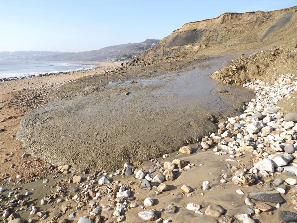
The combination of porous and permeable Upper Greensand resting on Lias clays is an ideal scenario for mass-movement(slumping). The situation changes continuously and is largely controlled by the weather especially rainfall. The picture above was taken in January 2013 after a prolonged period of wetter weather which affected many sections of the Dorset coast.
Another factor that affected the area in the past is periglacial solifluction. During the cold Pleistocene Ice Age events southern Britain was affected by permafrost (permanently frozen ground) with surface melting in summer months. Sandy material (from the Upper Greensand) was brought down slope and covered the clays. This solifluction material can now be seen in cliff sections (the paler material in the foreground in the picture above contrasting with the grey clays).
As with other sections of the coast it is important to time your visit with a low, ideally spring tide and relatively calm weather otherwise you might get cut off and escape routes are limited to one at St Gabriel’s Mouth. It is also possible to get fine views of the coast by using the coastal footpath between Seatown and Charmouth if tides or wave conditions are not favourable. The picture below shows how clay flows can cover the beach; this is a classic like a mud glacier!
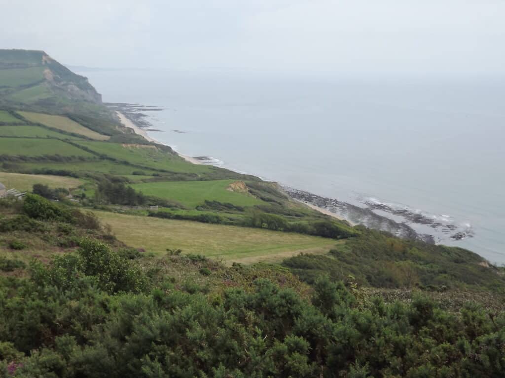
A useful alternative access point is via the National Trust car park on Stonebarrow Hill reached via Stonebarrow Lane on the eastern outskirts of Charmouth. From here there are footpaths which allow a circular walk including access to the cliff top. The O.S. Explorer Map sheet 116, Lyme Regis and Bridport is a useful asset for this. The picture below is taken from near Westhay Farm looking east.
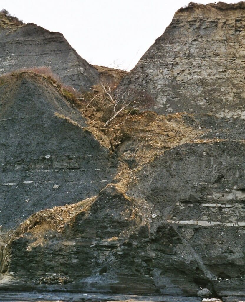
The cliff section between Golden Cap and Charmouth is dominated by members of the Charmouth Mudstone Formation, including the Black Ven Marl, Belemnite Marl and Green Ammonite Member. A number of species of ammonites can be found but you should remember the fossil collecting code and collect from fallen material rather than attacking the cliff face. Being too near the cliff face can be dangerous anyway because of the possibility of rock falls! As mentioned earlier faulting occurs and the displacement of the strata or either side of the fault is normally quite small. The movement on the faults would have triggered earthquakes and this probably occurred in mid-Cretaceous times. This also helps to explain the slight difference in dip between the Jurassic rocks and the overlying Upper Greensand. In the picture below the diagonal line of the fault can be seen although it is difficult to determine the amount of displacement because of lack of obvious marker horizons on each side of the fault. The fault line is a line of weakness which is being exploited by current weathering and erosion.
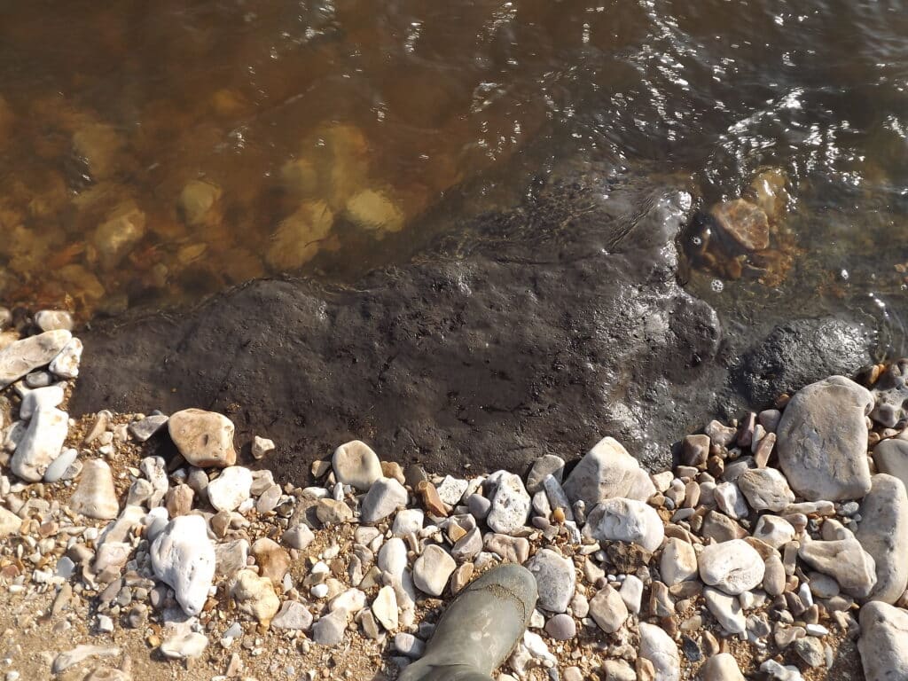
When you reach Charmouth, it is sometimes worth looking at the western river bank where remains of a submerged forest have been preserved. The wood was on this site before the post glacial sea level rise flooded the area around 6000 years ago. This has been identified as a DIGS site (Dorset’s Important Geological Sites Group) – see website
http://www.dorsetrigs.org.uk/southwestrigs/Charmouth/
Whether the plant material is visible depends on the River Char and its erosive processes!

Alan Holiday
PLEASE SUPPORT US FOR JUST £2 A MONTH

