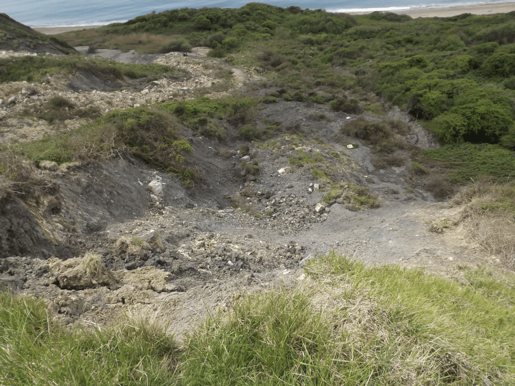
Ringstead Bay can be reached either along the coastal footpath from the east or via the minor road from the A353 east of Osmington. Parking is possible at the National Trust car park above Ringstead Bay and at the beach shop and café at Ringstead itself. Above the eastern part of Ringtead Bay is Burning Cliff so called because from 1826 to 1830 fires burnt due to spontaneous combustion of hydrocarbons in the Kimmeridge Clay (bituminous oil shale). It is thought that the mineral pyrite (fool’s gold) oxidised and in so doing produced heat which caused the bitumen in the Kimmeridge Clay to catch fire. There is no evidence of the burning now probably because landslips have removed the material down to beach level and it has since been eroded away. The picture below shows evidence of slumping below Holworth House, almost like a rock ‘glacier’.

The Kimmeridge Clay is fossiliferous with many ammonites and bivalves (oysters). These are often very fragile and difficult to collect. The picture below is quite typical with many shells squashed flat as the muddy sediment was converted into rock by pressure of more sediment and rock on top. The Kimmeridge Clay sea was warm and nutrient rich so there was plenty of food for the marine creatures that lived in the sea, hence a rich fauna.

Another common feature on the beach is large oval and rounded concretions, doggers or nodules which are made of calcium carbonate. These are called septarian nodules coming from the Latin word for wall (septa). If these are broken open you will see white or colourless crystals of the mineral calcite. The second picture below is a cut section through a nodule.


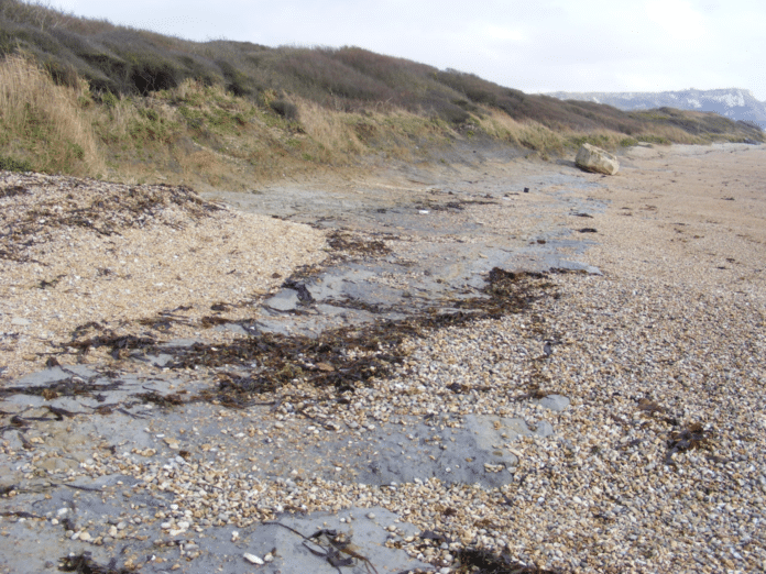
Moving west, coastal protection has been put in place at Ringstead to protect property above the beach. Rock armour has been used (large blocks of Portland Stone – limestone) as well as a beach replenishment scheme using imported gravel which was instated in the early 1990s. Obviously this was beneficial for the property owners but covered up the geology! After stormy weather the beach shingle has sometimes been eroded (see picture below) and the Ringstead Waxy Clay exposed which is highly fossiliferous. This rock forms the top of the next geological unit moving down the rock succession as is part of the Corallian seen working west to Osmington Mills.

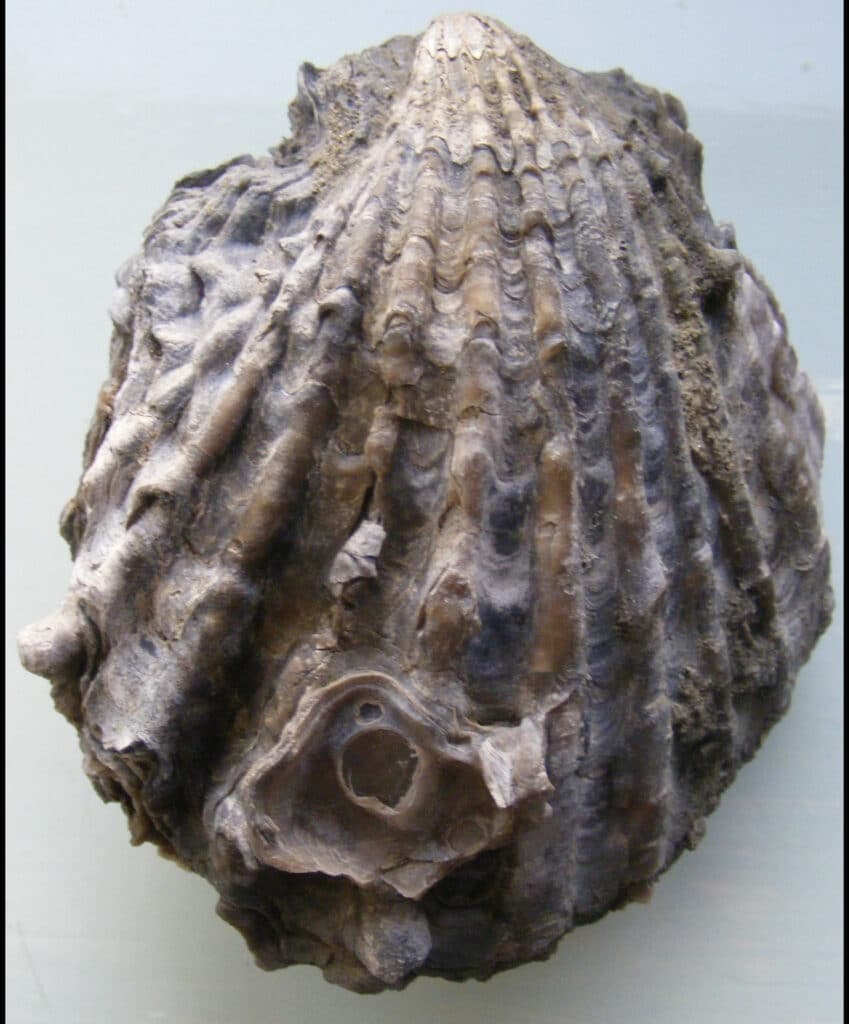
The rather nice bivalve, Ctenostreon (similar to an oyster) in the picture below was extracted from the clay. It is around 10cm long. Other fossils that can be found include coralsindicating that when the rock was formed conditions were tropical or sub-tropical.

Walking towards Bran Point there are ridges of stronger rock formed of beds of limestone rich in fossil shells, especially one called Myophorella (formerly called Trigonia). These fossils occur in large numbers are would have been shell banks on the sea floor in Jurassic times. They are very common in the Corallian rocks between Ringstead and Weymouth.

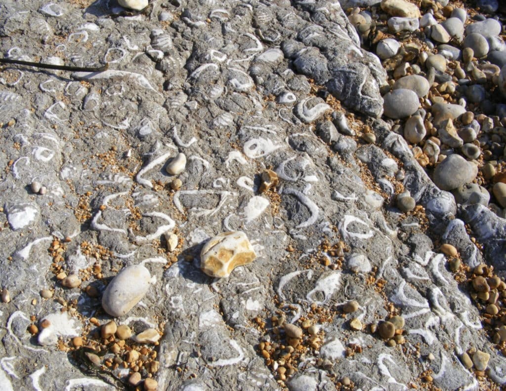
Trace fossils are also common nearer to Bran Point (at the western end of Ringstead Bay). Trace fossils are not actual creatures but where creatures have been and include tracks and burrows. The picture below is of worm tubes in limestone at Bran Point. The limestone is often oolitic with small (0.5mm diameter) grains of calcium carbonate. Similar limestone is forming now in shallow tropical seas such as in the Caribbean.

Alan Holiday
PLEASE SUPPORT US FOR JUST £2 A MONTH
If you prefer demanding content that turns the apple cart upside down please SUBSCRIBE to our Youtube channel: https://www.youtube.com/channel/UCQ1Ll1ylCg8U19AhNl-NoTg


