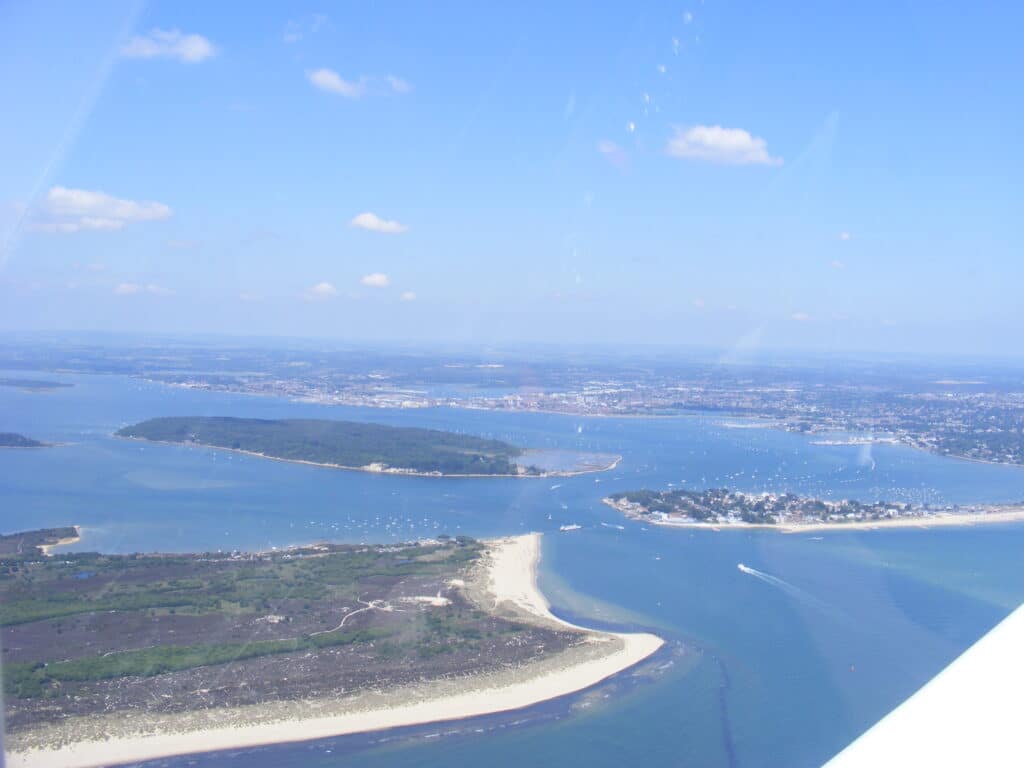
Brownsea Island is the largest of the islands in Poole Harbour and is owned by the National Trust (NT). As a result the island is relatively unspoilt and undeveloped compared with its close neighbour the conurbation of Poole and Bournemouth! In the picture below you can see Brownsea Island in the centre of the picture with the Studland peninsula front left and the Sandbanks peninsula front right with Poole and Hamworthy beyond.

The geology of Brownsea Island is dominated by sands and clays from the Palaeogene (mid-Tertiary 40-49 million years ago) and these were deposited in swamps, estuaries and deltas in relatively low energy conditions, hence the fine nature of the sedimentary rocks (sandstone, siltstone and clay). The best exposed geology is on the south side of the island and it is normally fairly easy to walk along the beach. Former coastal defences which had fallen into disrepair have been removed and the NT is now allowing the low cliff to erode. The picture below shows the Branksome Sand Formation and the fallen vegetation shows that the cliff is eroding. Little can be done about this hence the NT implementing a policy of ‘no active intervention’ along this section allowing nature to take its course. Cost benefit does not work in favour of protecting the cliff, i.e. the cost of any remedial work set against economic or any other benefit.

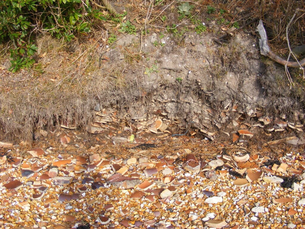
At the western end of the beach is Pottery Quay where in the late 19th century, a local entrepreneur was hoping to make his fortune from exploiting the clay for the making of bricks and tiles but the business failed. Large amounts of broken pipes and other clay products can be seen on and around the beach as in the picture below.

The DIGS website has further information on the geology of Brownsea Island and a number of other geologically interesting sites in the area. Go to http://www.dorsetrigs.org.uk/ )
The other DIGS sites around Poole Harbour include Shipstall Point which is reached through the Arne Nature Reserve where you can see Palaeogene, Poole Formation sands as well as more recent river gravels (Quaternary). Coarser sands and gravels can be seen further west at Redcliff Point, Arne, also described on the DIGS website.
Another feature of interest in the Poole Harbour area is the Wytch Farm Oilfield that has been producing oil and natural gas since 1979. Evidence of this important oilfield is limited as it is well camouflaged by surrounding coniferous woodland but in the picture below you can see the drilling derrick which is periodically present on the Goathorn Peninsula. The view is looking north from above Brand’s Bay across the Goathorn Peninsula to Green Island and Furzy Island (where there is an oil well) andto Brownsea Island and Poole. Further information on the oil field can be found on the website link below.
http://www.hydrocarbons-technology.com/projects/wytch-farm-oil-field/

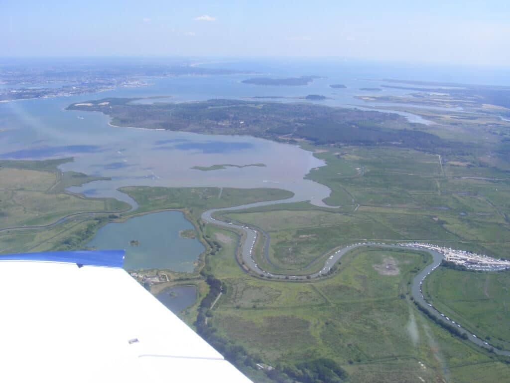
Another DIGS site of geological interest is Whitecliff in Poole Park where the Parkstone Clay of the Poole Formation is exposed. These were originally deposited around 30-40 million years ago in an estuary of a river which flowed from west to east rather like the River Frome does now although the geological river flowed from further west possibly from what is now Devon. The picture below shows the River Frome entering Poole Harbour now and the low lying marshy ground is apparent alongside the meandering river. The environment would have been similar in Tertiary times only sub-tropical and the area probably would have been thickly wooded!

The clay extracted was used for making pipes as well as terracotta tiles similar to those on the gates of Poole Park. Further information can be seen at the site and on the DIGS website.
Alan Holiday
PLEASE SUPPORT US FOR JUST £2 A MONTH


