
This walk starts at the village of Poxwell just to the east of the turning to Ringsteadoff the A353 at GR SY742835 (nearest postcode is DT2 8ND). There is limited parking at this site and in winter the ground can be very muddy! To follow this walk it is recommended you use the Purbeck and South Dorset O.S. Explorer map OL15.For full details send document at end of this outline.
It is probably best to start by explaining what is a pericline. This is a geological term for a fold structure, either a dome or a basin shaped structure – imagine a pudding basin. The Poxwell structure in an elongated dome and during this excursion you are walking round the dome.
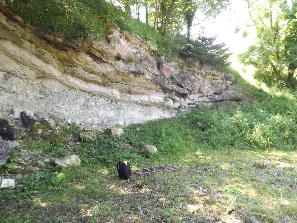
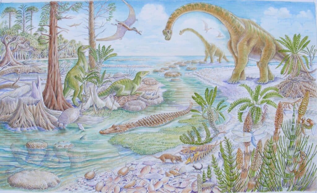
Start by going through the gate along the bridleway and immediately on the left, in the fenced off area by the mobile phone mast, is Poxwell Quarry which is a DIGS site (see end for more details on DIGS). The rock exposed is a white or pale grey limestone, the top of the Portland Beds and the base of the Purbeck Beds of late Jurassic age, around 145 million years old. Similar rocks are also seen on Portland for example in Kingbarrow Quarry. The rock is dipping due to earth movements which created the pericline. The fold is aligned east west and this is because the pressure that created it came from the south during the formation of the Alps around 20-30 million years ago. The east face of the quarry (it faces you as you walk through the gate has chert rich Portland Limestone and with careful observation you could see a large ammonite (Titanites – which is the zone fossil, characteristic of rocks of Portland Limestone age). Some of the limestone beds are also quite shelly with oysters. The southern rock face (seen in the picture below), on the right as you walk into the quarry, has stromaolitic limestone formed by algae and there is also a dark layer which is a fossil soil formed as the Jurassic sea level fell and land was formed which was colonised by trees, conifers and tree ferns as seen in the second picture below.
Stromatolitic limestone can also be seen at Kingbarrow Quarry on Portland and at the Fossil Forest east of Lulworth Cove in the Army firing range.
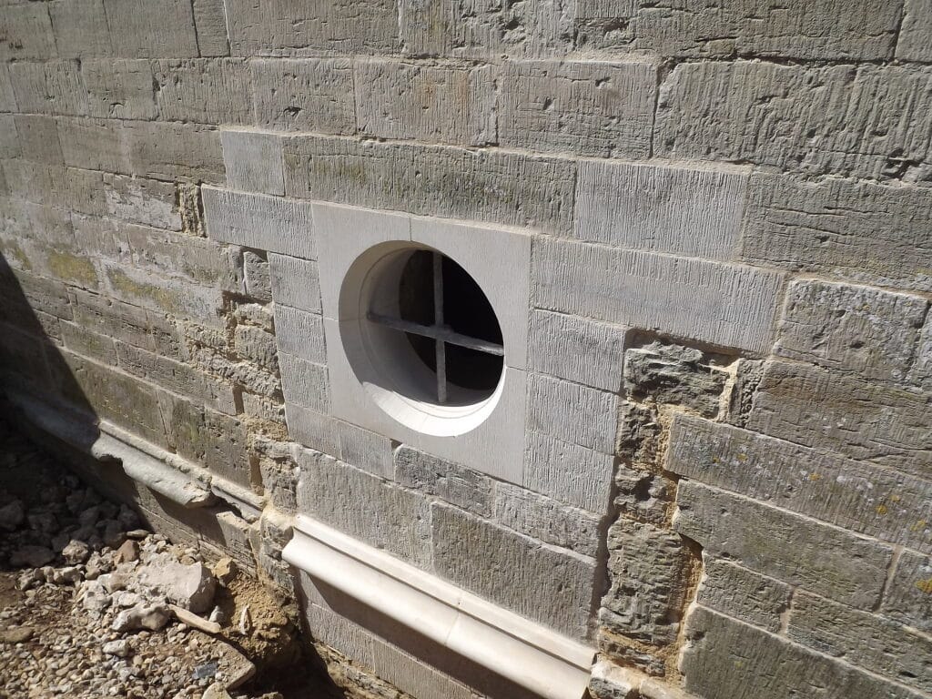
If you leave the quarry and return to the bridleway on your left are the remains of a lime kiln and further on there is a more recent excavation where stone was quarried to carry out conservation work on the Wolfeton Riding House near Dorchester. The DIGS group was consulted to find a matching stone for this work. Initially the new stone stands out but it will soon weather and blend in. See an example below.
Continuing on along the bridle path, the land rises and you will see the land falling away on the right (south). This is because the rock changes from the harder Portland and Purbeck Beds to softer Cretaceous Wealden Beds made of sandstone and clay.
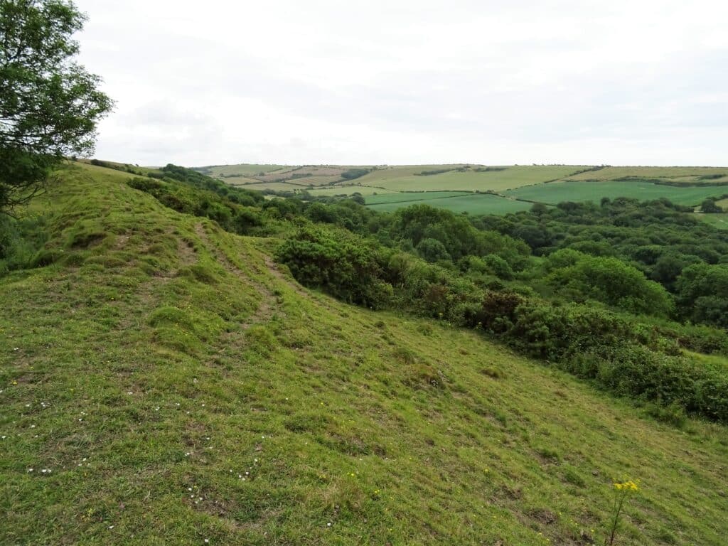
You may also notice that the ground next to the footpath is quite hummocky. This is because quarrying took place along the line of the Purbeck Beds in the past. The aerial picture below shows this as well as evidence of the impact of the pericline on the landscape.
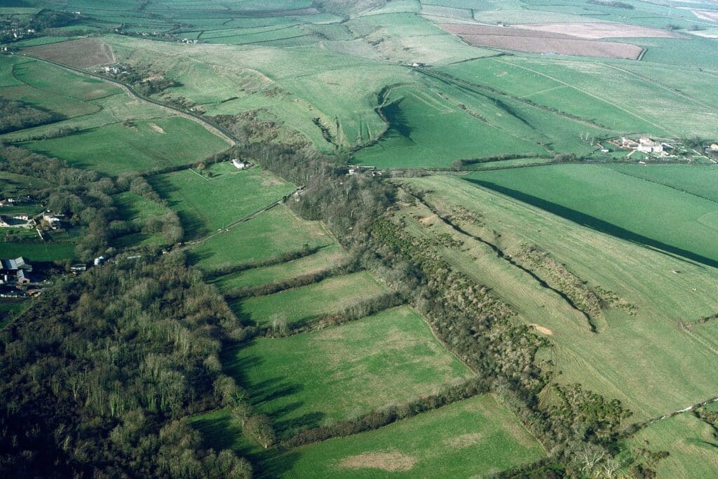
If you leave the footpath and walk up slope (to the north) you can see down into the centre of the fold which has been eroded away to expose the Kimmeridge Clay. The depression can be seen towards the top left of the aerial picture above.
As you continue eastwards and then north you walk around the end of the Kimmeridge Clay valley and cut across to a new farm track which takes you down to Moigns Down Barn. You are now walking west with the Chalk on your right and the Wealden Beds valley on your left.
At Moigns Down Barn bare left and follow the footpath back towards Poxwell Manor.On your right, to the east you will see the lower lying land of the Wareham Basin with younger sands and gravels deposited around 50 million years ago (Tertiary, Palaeogene). If time allows cross the A353 and walk around the end of the fold before returning to your starting point. Take care crossing the A353! This is a much abbreviated description and a free leaflet is available from DIGS and can be obtained by making contact through the website or you can download the text from
Further information on DIGS and the Poxwell Quarry can be found at http://www.dorsetrigs.org.uk/southwestrigs/poxwellquarry/
Alan Holiday
PLEASE SUPPORT US FOR JUST £2 A MONTH
Geological formations mentioned in the text
The Kimmeridge Clay, Portland and Purbeck limestones and the Wealden Clays were deposited during the late Jurassic and early Cretaceous Epochs. They were then folded and faulted and subjected to sub-aerial erosion before the Gault, Greensand and Chalk were deposited. The Gault and overlying beds therefore rest unconformably (they do not conform to the same structures of the underlying strata) on the older rocks. During the much later Alpine earth movements (20-30 m.a.) the whole sequence was folded again to produce the pericline and to re-activate the earlier faults. The Wealden beds do not occur on the north side of the fold, being eroded in this area before deposition of the Gault, that is, they are cut-out by the unconformity.
FOREWORD
From “The Geology of the Isle of Purbeck and Weymouth” by Aubrey Strahan Mem. Geol. Surv. HMSO. 1898
At Poxwell the ground furnishes a beautiful example of the dependence of physical feature on geological structure. A sharp anticline, with dips of 40° to 65° and of 25° to 30° on its north and south sides respectively, brings up an oval inlier of Portlandian strata along the middle of a tract of Purbeck rocks. Round the inlier runs an almost continuous wall-like scarp of Portland Stone, while within it there are undulating meadows underlain by the softer Portland Sand. This pretty hollow, which is suitably known as Poxwell Circus, is about a mile and a quarter long and from two to three hundred yards broad.
INTRODUCTION
The Poxwell Pericline is one of the best examples in the UK of a landform reflecting an unusual geological structure. A pericline is an elongated dome-shaped fold of rock strata, rather like an upturned boat. In this case, the apex of the fold (the keel of the upturned boat) has been eroded away leaving the fold edges sloping away in opposite directions (the sides of the boat). These edges close together at each end of the structure (the bow and stern of the boat).This feature is south of Poxwell,
about 7 kilometres (just under 41/z miles) east of Weymouth along the A353.
The walk of about 5 kilometres (just over 3 miles) takes you anticlockwise completely round the structure that was the site of an early search borehole for oil drilled by the D’Arcy Exploration Company (later taken over by BP) in 1937. It has no very steep gradients. It is entirely on public rights of way, in this case all bridleways, which can easily be followed on Ordnance Survey Map “Outdoor Leisure 15 of Purbeck & South Dorset”.
Parking for the starting point at Poxwell old quarry (SY743835) is limited to space for a few vehicles in a wide track marked by a bridleway finger post to Holworth and East Chaldon. Care should be taken in approaching and exiting the parking site as it is immediately off the A353 with fast moving traffic. Make sure the farm gate is kept clear.
All the land you will cover is in private ownership. Please respect the Code for Geological Fieldwork (published by the Geologists’ Association) which incorporates the Country Code. In particular, no hammering anywhere.
THE WALK
The old quarry (A) is a RIGS (Regionally Important Geological Site) and is now the site of a Vodafone mast, the installation of which provided excellent access to the quarry and also paths within it to facilitate all round viewing of the strata. A photograph of the west-facing exposure is shown below.
The quarry exposes Portland Stone overlain by Purbeck Beds of the Lulworth Formation dipping south at about 30° on the southern side of the pericline. The massive Portland Limestone can be seen at the base of the exposure followed upwards by thinner limestones at the base of the Purbeck Beds. The massive bed (partly covered with vegetation) at the top of the section is algal limestone and is the horizon of the “fossil forest” so well exposed at Lulworth and on Portland. Two dark grey layers are visible which are fossil soil horizons in which the vegetation grew. In the north quarry face the Portland Limestone contains chert and the outer whorl of a large ammonite Titanites can be seen high in the exposure. Other fossiliferous beds can be seen with careful observation. A worksheet with more detail is available on the Dorset RIGS website and through the Purbeck Keystone Project.
Leave the quarry to take the bridleway to the east, noting the old limekiln on your left. As the track rises to clear the trees it crosses a line of old workings in the Purbeck Beds (B). Note the view behind across Weymouth Bay to the Isle of Portland (also composed of Portland Beds overlain by Purbeck strata dipping very gently south). Outcrops of Portland Stone can be found on the hill to the left (north).
The bridleway rises up the hill, tending to fade away and swing to the north. Ignore this and carry on roughly following the contour towards a distant gate. Pause to look south, down the dip slope of the Purbeck Beds, across the Upton Valley cut into Wealden Clays and note the prominent ridges running parallel to the valley (E-W) on the opposite slope. These are more resistant grit horizons within the clays.
The bridleway passes left of the gate following the field boundary on your right. Go through a galvanised gate just south of a small reservoir. The route of the bridleway is now very unclear, but but turn to the left along the field boundary across the ridge (of Portland Stone) to another galvanised gate. Go through this gate, at which point the elongated eroded core of the pericline becomes apparent (C). The middle of the “upturned boat” has been eroded away exposing the softer Kimmeridge Clay and leaving rims of harder rock dipping away, north and south from the E-W axis. In the low ridge opposite, across the depression floor, you can see rock outcrops (D). These are Purbeck Beds dipping north on the northern side of the fold.
Continue eastwards following a now well-defined track. After 200 metres or so the track doglegs left and then right. At this point (E) you can stop and look west along the axis of the fold (see over page for photograph). The basin shape across the fold is very obvious with Purbeck and Portland beds forming the sides, the lower Portland Beds (Portland Sands) being eroded out down to the underlying Kimmeridge Clay at the bottom of the basin. The gentle rise to the middle distance is to a col across the middle of the pericline structure. In the far distance, half-left, Weymouth can be seen across Weymouth Bay.
Continue eastwards along the bridleway to a gate. At this point, or thereabouts, you cross the unconformity between Purbeck Beds (south) and Greensand (north). Go through the gate, turn sharp left to another gate on your left. Go through this gate and follow the well-defined track westwards towards the barns. This track is on Greensand with Chalk very close by on your right. If the narrow elongated field on your left has been ploughed, you can see limestone debris in the soil on the south side (from the adjacent Purbeck strata; good sandy loamy soil in the middle (Greensand), and chalky debris on the north side against the bridleway (proximity of Chalk).
About half way down the track to the barns, a small quarry on your right exposes Chalk (F). Note the considerable thickness of “Drift” on top of the Chalk. At the bottom of the slope go through the gate and turn right. Here are quite extensive exposures of Chalk, still occasionally worked (G). The Chalk is pale grey in colour (indicating that it is towards the base of the formation) and is rather disturbed, due almost certainly to the proximity of the E-W trending Poxwell Fault. It should be possible to discern a dip in the Chalk to the north at about 25°. Behind you a track leads to the rising ground of the Purbeck Beds (about 100 metres) where there is evidence of past quarrying
The bridleway continues north through Moigns Down Barn. At the end of the barns, before the ruined house, bridleway markings on a gate show a route straight on and to the left. Turn left before the gate, through another gate and then right across rough land to yet another gate. The bridleway track here is not obvious, but it goes up the hill to the northwest following the field boundary.
NOTE. Navigation in the Moigns Down area can be difficult especially when vegetation growth (nettles and thistles) is vigorous and can be very wet with large puddles.
Continue past the barn (H) at the top of the hill where the track doglegs left and then right. Follow the now obvious track westwards, then southwards for a short stretch past an old, largely filled, shallow quarry in Chalk (J). Turn right (westwards) again down the slope to the A353 at Poxwell Manor. Pause down the slope to observe half-left (looking to the southwest) the closure of the western end of the pericline in the opposite hillside.
Cross the main road and continue on the now tarmac bridleway past a small cemetery on the left. Carry on up the slope, through a gate and half-right up the hill towards Pixon Barn. There are good views back to the east over the pericline towards the col. At the top of the hill turn sharp left on the bridleway sign-posted to Holworth. As the track rises over the hilltop, White Nothe headland can be seen straight ahead with Weymouth Bay and Portland on your right. Under the power line, move a few metres off the path to your left to stand on the axis of the pericline at its western end looking east (K). Again, as with the view from the other end, the flanks of the hollow are formed of Purbeck and Portland Beds whilst Kimmeridge Clay occurs at the valley bottom crossed by the A353.
Continue southeast down the bridleway past extensive old workings on your right in Purbeck Beds dipping south at 25° -30° (L). This is a Site of Special Scientific Interest because of rare insect remains found. On reaching the main road take great care crossing it (you are on a sharp corner and traffic is usually travelling fast) to return to the parking area just to the north. Other interesting exposures of dipping strata can be seen on the north side of the road but should be viewed from the pavement on the south side of the road.
Glossary
alga) – secreted by algae (microscopic organisms)
chert – nodular silica (SiO2) in limestone (flint is similar material in Chalk) col – depression in a hill summit (rather like a saddle shape) drift – unconsolidated material of geologically recent origin m.a. -million years ago
DIGS gratefully acknowledges The Curry Fund of the Geologists’ Association for a grant towards the printing costs and also Mrs Francesca Radcliffe for permission to print the front cover aerial photograph of the Poxwell area.


