
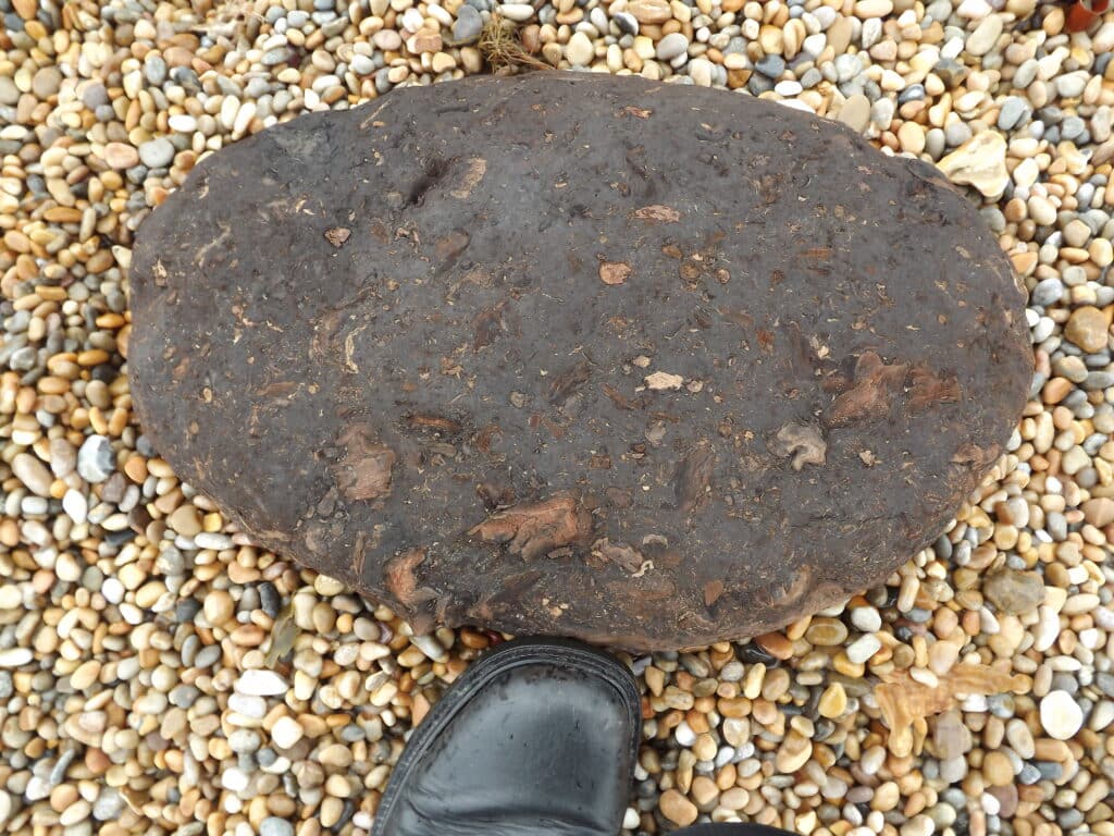
Continuing our journey along the coast from Abbotsbury, as mentioned in a previous instalment (22 on Chesil Beach), peat can be washed up on the Beach during storms as seen in the picture below. This would have formed in the Fleet when Chesil Beach was further off-shore. Over the centuries and even millennia the Beach has moved landward during stormsand peat deposits, once in the Fleet, are now on the sea-floor off-shore. Peat can be seen periodically on the beach at Abbotsbury and West Bexington.
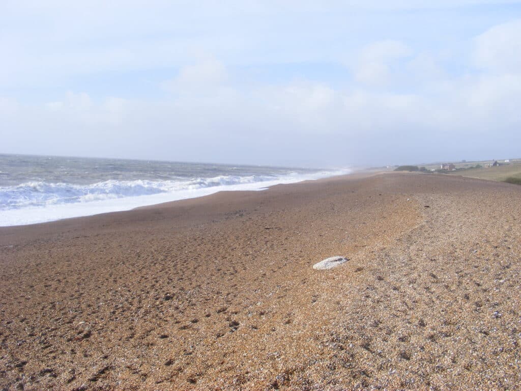
There is little obvious geological interest between Abbotsbury and Burton Bradstock as there is little exposure of rock due to the rock being largely clay which, as it is soft, is easily eroded. Between East and West Bexington there is a geological fault and there is a change from Oxford Clay to Frome Clay / Fullers Earth Clay. However, the change is not obvious due to poor exposure. Chesil Beach acts as a natural coastal defence limiting any erosion of the bedrock. The picture below, taken at West Bexington looking N.W., clearly shows the low lying nature of the coast. One thing to notice along this section of the beach and seen in the picture above is the size of the ‘shingle’ which is around 10mm in diameter (called pea grit because of its size), markedly different to that seen at Portland.
On approaching Cogden Beach there is a low cliff which israther degraded due to landslip (clay flows) especially after wet weather. Fossils can be found in the clay but they are not common and the most likely find are slabs of blue grey oyster bed.
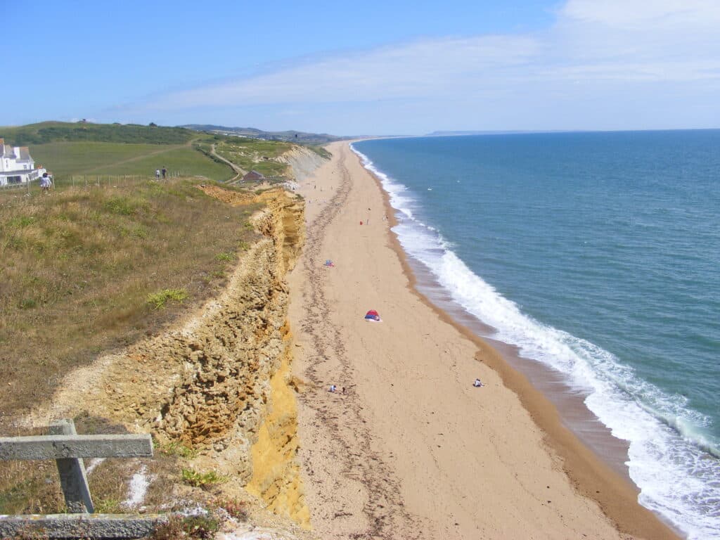
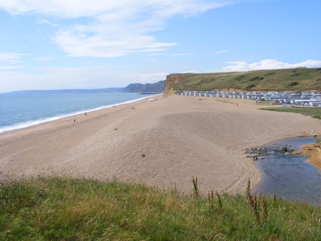
The picture below shows the dramatic change in the coast at Burton Bradstock from the low grey sloping cliff on the Fullers Earth Clay/ Frome Clay to the bright yellow orange of the Bridport Sand. Where the Hive Café is located there is a geological fault and the area to the S.E. has dropped by as much as 60 metres compared with the area to the N.W. in the geological past. I should point out this picture was taken in 2010 before this section of the coast path was fenced off due to the risk of rock falls.
During storms the sea breaks against the base of the Burton Cliff causing it to be undercut.
It eventually becomes unstable and there are rock falls, sometimes quite substantial and covering sections of the beach. Large vertical joints (cracks) add to the risk of rock falls. The fatal accident in July 2012 is a reminder to us of how dangerous the cliffs can be but people still ignore the signs as seen in the picture below! You can never be sure when a rock fall will occur but the best time to walk this section is on a low spring tide which coincides with the new moon and full moon and when the sea is calm so you can walk near the water’s edge.
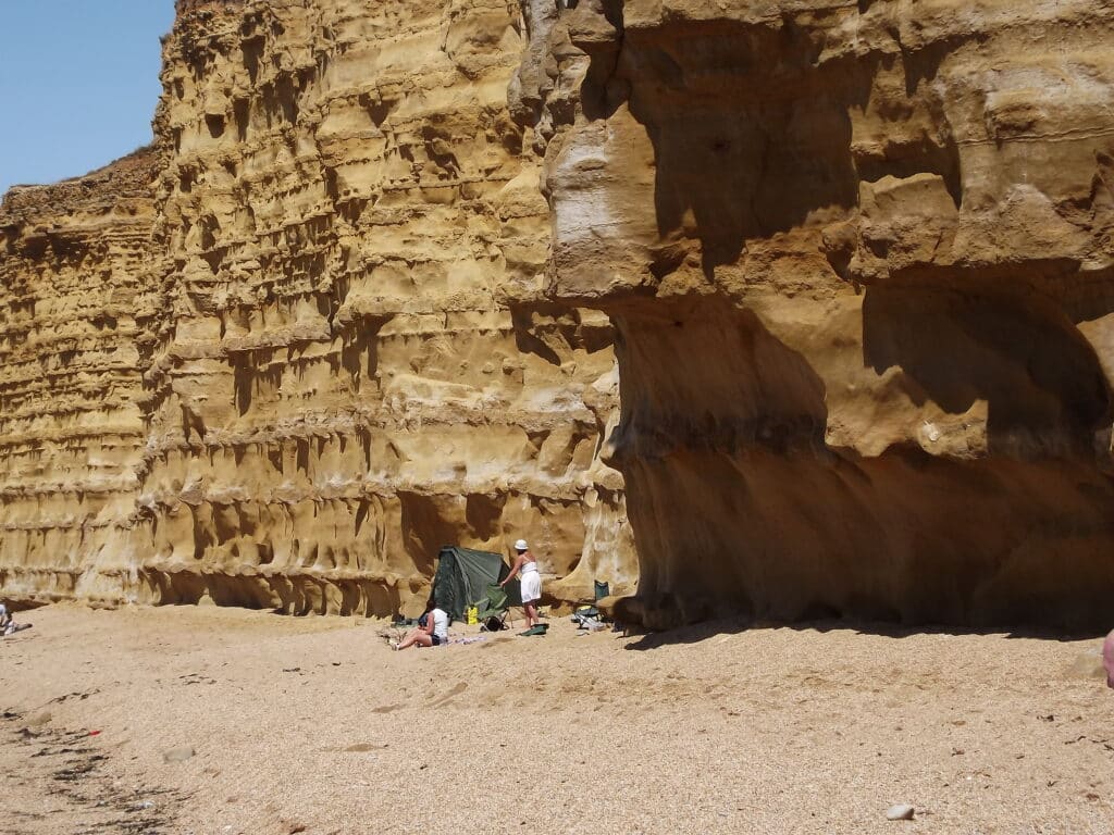
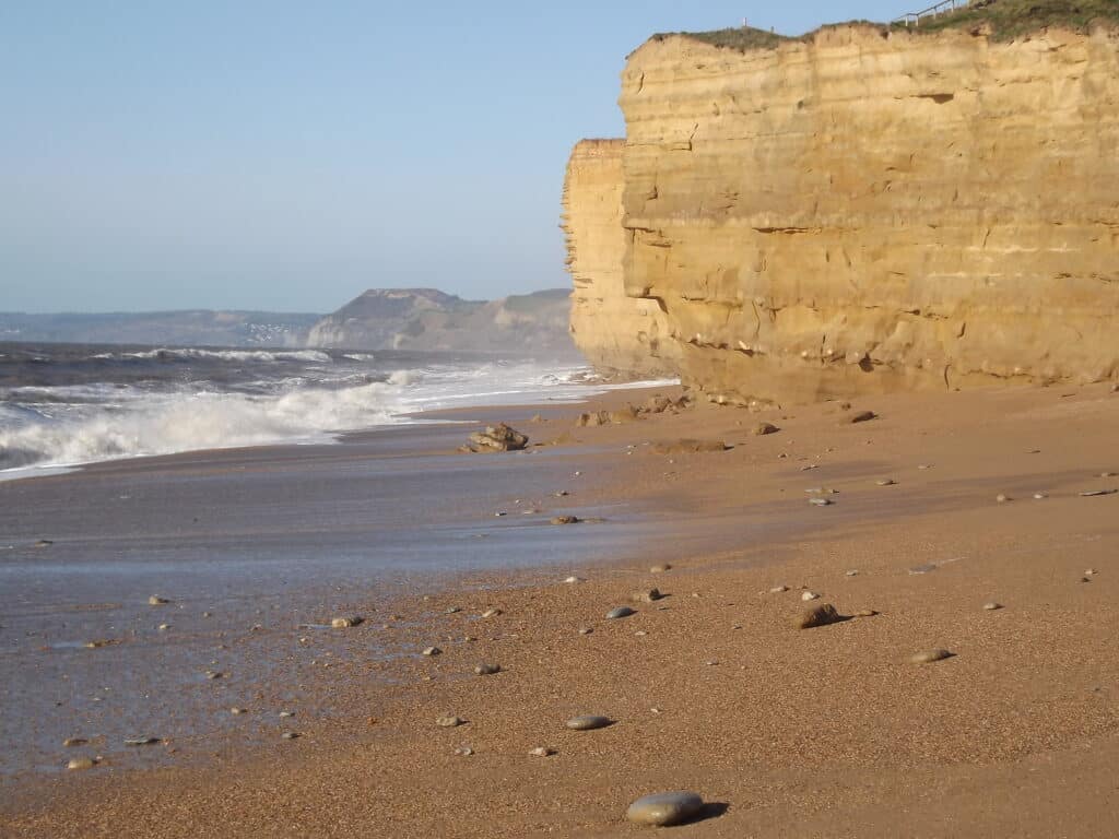
Burton Cliff is made of Bridport Sand (around 180 million years old), the top unit of the Lower Jurassic (Lias). Nearer to Freshwater there is a capping of Inferior Oolite limestone and also some Fullers Earth Clay / Frome Clay. As this clay is at sea level at Cogden Beach it gives some idea of the movement on the fault mentioned above. The Bridport Sand is a fine grained, poorly cemented sandstone and contains few fossils. It is an important rock as it is one of the reservoir rocks (a natural store of oil and natural gas in the pore spaces between the sand grains) for the Wytch Farm Oilfield in the area between Wareham and Poole Bay. This was the largest onshore oilfield in Western Europe at one time but now production is tailing off. The Sherwood Sandstone seen on the coast at Budleigh Salterton is another, and a much more important, reservoir rock. Due to the dip of the rocks those seen at sea level in Devon and West Bay are at 1600 and 900 metres below the surface in the Wareham area. The banding you can see in the picture above is where the sandstone beds vary in hardness due to how well cemented the sandstone isand is a good example of differential weathering and erosion. How prominent the beds are is an indication of the time since a rock fall affected a section of the cliff. Similar cliffs extend to West Bay Harbour with a gap at Freshwater where the River Bride reaches the sea seen in the picture below.
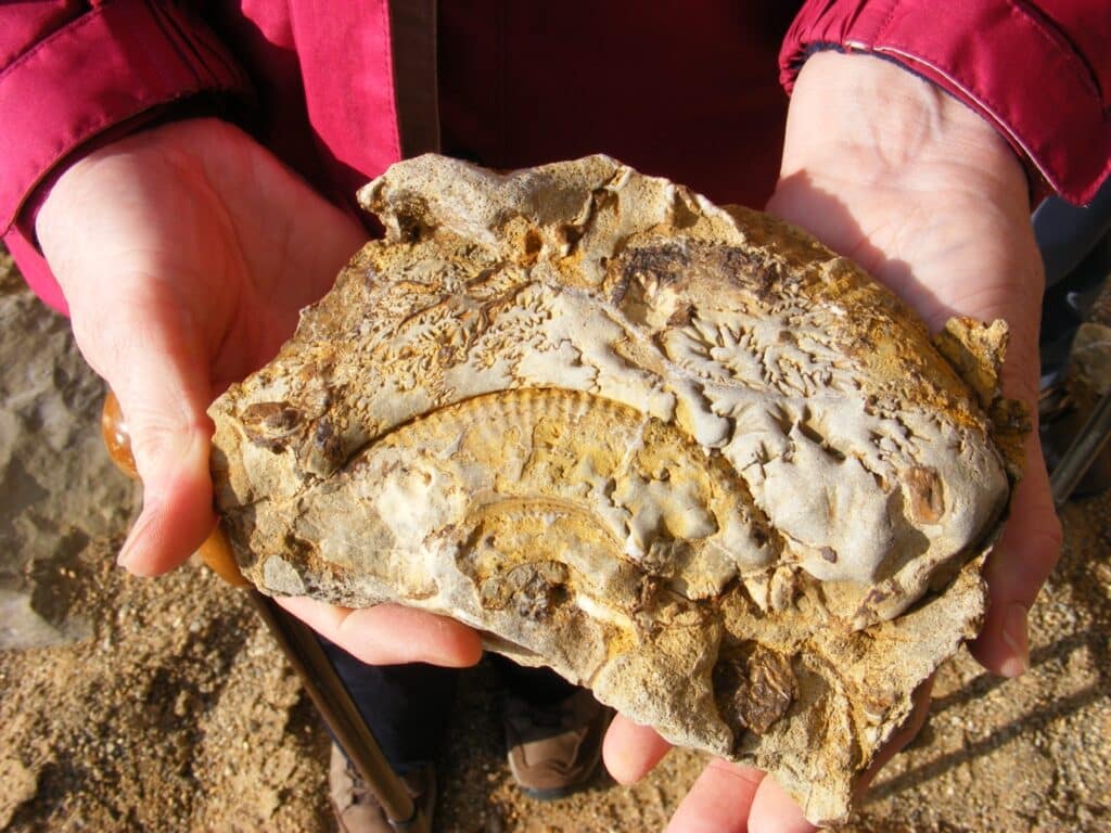
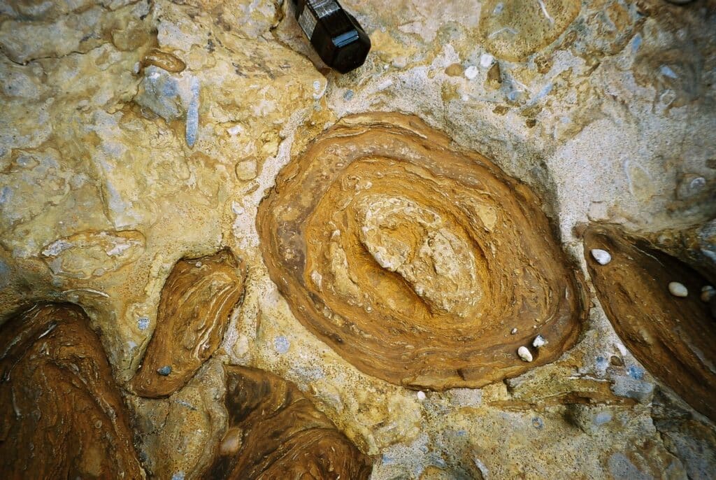
As mentioned earlier the cliff top near Freshwater has a capping of Inferior Oolite which unlike the Bridport Sand is very fossiliferous. It can only be studied after rock falls have occurred and many fossil collectors are attracted to the area.Part of an ammonite is seen in the picture below. The rock is full of fossils and geologists called this a condensed sequence because there is little sediment deposited but life went on and the fossils were preserved. Apart from ammonites, belemnites, bivalves, brachiopods and sponges also occur. There is also a horizon where flattened oval concretions called snuff boxes can be seen!
Join us in helping to bring reality and decency back by SUBSCRIBING to our Youtube channel: https://www.youtube.com/channel/UCQ1Ll1ylCg8U19AhNl-NoTg SUPPORTING US where you can: Award Winning Independent Citizen Media Needs Your Help. PLEASE SUPPORT US FOR JUST £2 A MONTH https://dorseteye.com/donate/


