
Chesil Beach extends for 28km from West Bay to Chesil Cove on Portland. It is termed a tombolo i.e. a beach which joins an island to land.
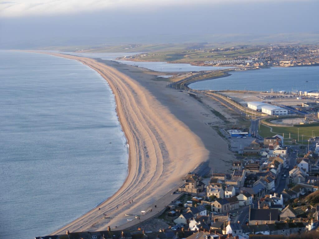
It was brought to its present position as sea level rose after the last glacial event during the Pleistocene. Around 17,000 years ago sea level was around 100 metres lower than at present as the water was locked up in glacier ice. As the ice melted the sea level rose and the shingle gradually moved to its present position 5-6,000 years ago. Sea level has been relatively stable for the last 6,000 years. The beach is gradually moving landward because if there is a storm waves push shingle from the seaward side to the landward side. There is no process to push the shingle in the opposite direction. During the storms in early 2014 the crest of Chesil Beach moved on average 4 metres towards the land and up to 10 metres in extreme cases. The picture below was taken in Chesil Cove on 8th February 2014 during one of the storms.

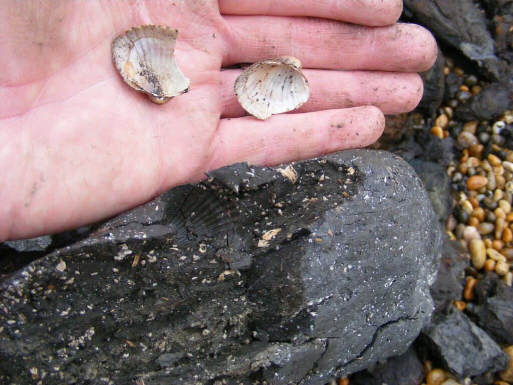
Evidence of how the beach has moved over time is shown by peat which is occasionally washed up on the beach from offshore. This can be seen at Abbotsbury and West Bexington. The peat accumulated in the Fleet during the last 6000 years. The Fleet formerly extended further west but now the beach has moved towards the land and the old peat deposits are off-shore. During storms wave action rips up the peat in shallow water and deposits it on the beach. The picture below was taken on the beach at Abbotsbury in February 2011 and shows shells of creatures that lived in the Fleet, not a lot different to now (cockles and snails).
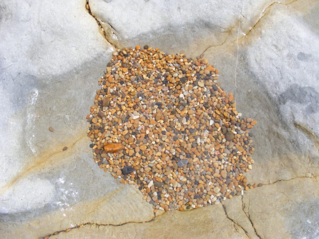
The beach is made of shingle from pea size (pea grit) at the West Bay end to cobbles (>5 cm) at the Portland end. The pebbles are made of very resistant flint and chert (derived from the Chalk, Upper Greensand and the Portland Limestone. There are also quartzite pebbles which were part of the Budleigh Salterton Pebble Beds (from east Devon) and were eroded from the cliffs and transported eastwards by long-shore drift. Erosion during the Pleistocene would have brought large amounts of rock debris down slope into what is now Lyme Bay. As the sea level rose wave action would have rounded and sorted the shingle. The picture below shows the pea grit in a rock pool below the cliffs at Burton Bradstock.
The picture below is of one of the pebbles from Chesil Cove and is made of Portland Limestone chert. The pebble shows a fossil (Aptyxiella portlandica or the Portland screw) as well as the oolitic texture from the original limestone that the chert replaced.

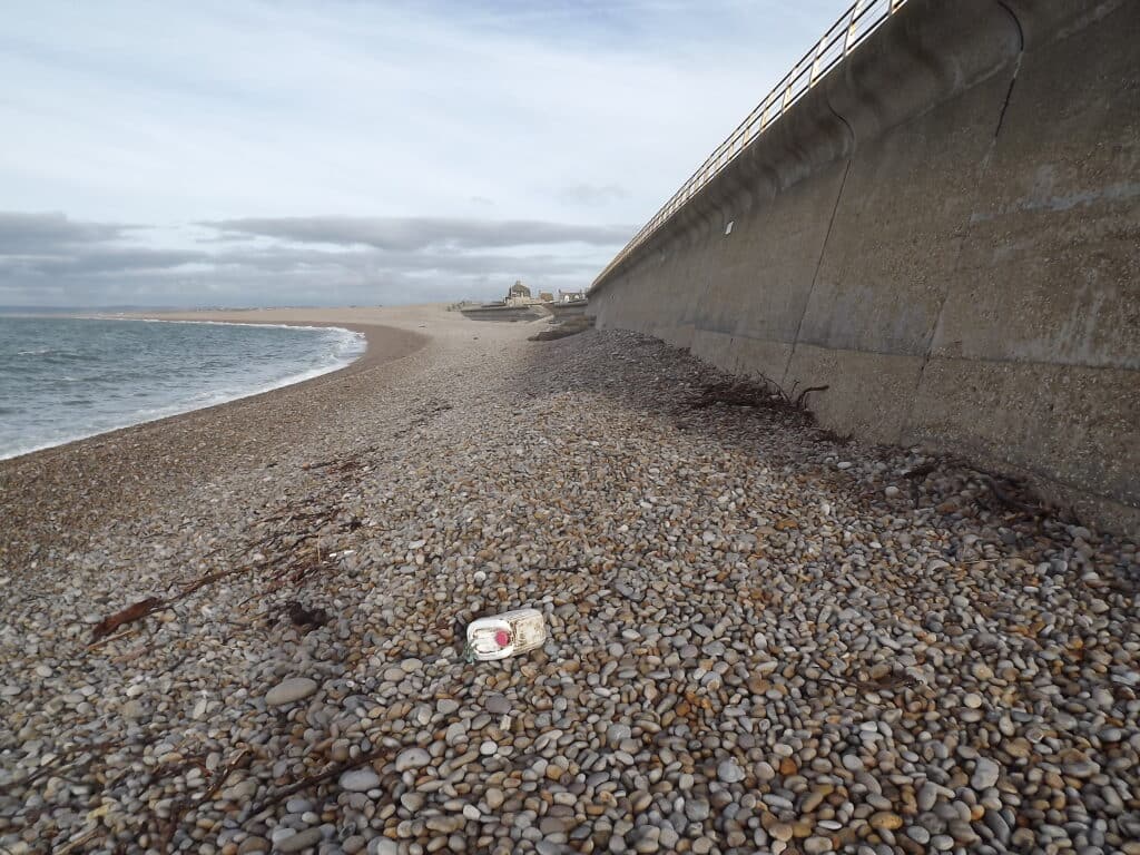
Chesil Beach is a fossil feature as there is no new supply of sediment from the west due to the harbour and coastal defences at Lyme Regis and West Bay. As a result it is illegal to remove pebbles from the beach. Despite it being a fossil feature it does change over time as was shown by the storms in early 2014. The beach was completely wash away in places in Chesil Cove by 16th February 2014 and the underlying Kimmeridge Clay was exposed. The beach was lowered by 3.5-4 metres. However by January 2015 the beach had largely recovered to its original state (compare the two pictures below).

Water can pass through the beach via the spaces between the pebbles during high tides and storms. Depressions called canns can be seen on the landward side of the beach and many were formed during the storms in 2014 as water poured through the beach. This is another way in which the beach is moving landward. Large lobes of shingle can be seen on the water’s edge of the Fleet. The picture below was taken in August 2014 near Langton Herring. Fresh lobes of shingle have covered some of the vegetation (shrubby sea blight) which grows along the lee shore of the beach

Join us in helping to bring reality and decency back by SUBSCRIBING to our Youtube channel: https://www.youtube.com/channel/UCQ1Ll1ylCg8U19AhNl-NoTg SUPPORTING US where you can: Award Winning Independent Citizen Media Needs Your Help. PLEASE SUPPORT US FOR JUST £2 A MONTH https://dorseteye.com/donate/


