The Fleet is a lagoon behind Chesil Beach and extends from Abbotsbury to Ferry Bridge from where it opens into Portland Harbour and then into Weymouth Bay. The picture below shows Lyme Bay on the left, then Chesil Beach and the land of south Dorset on the right
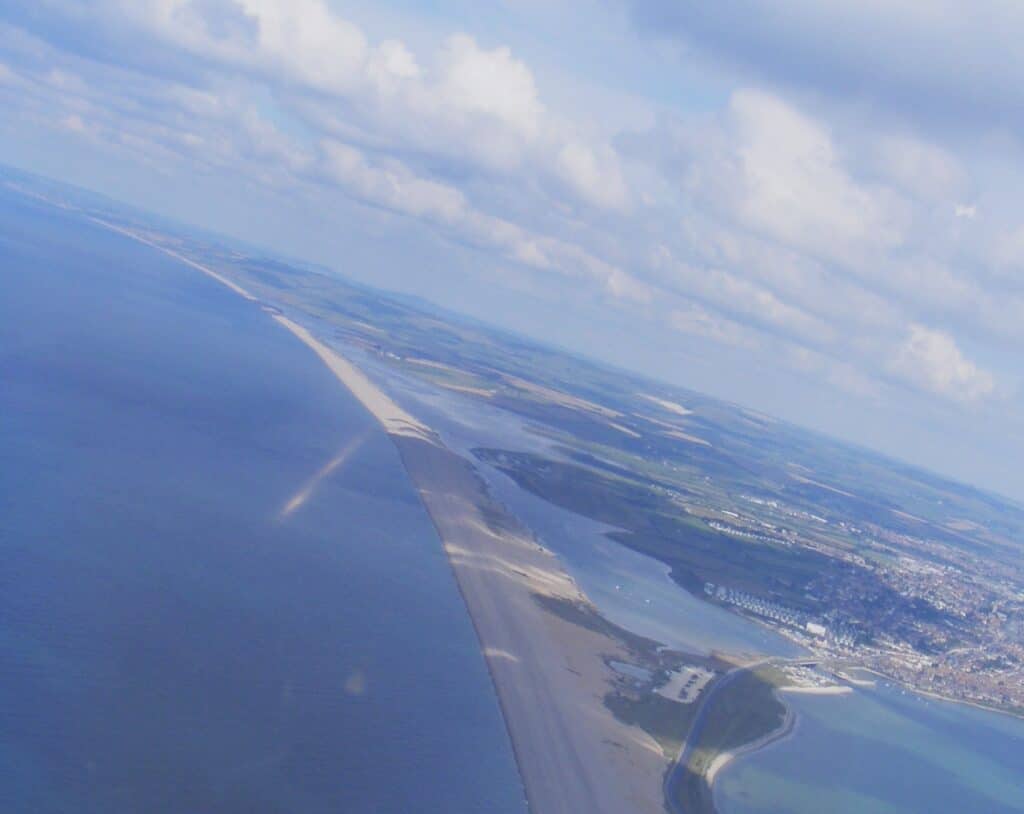
The Fleet is tidal especially in its lower section nearer the sea but the tidal impact lessens north-westwards and is also later(i.e. the tidal effect is delayed compared with the open sea). The water also becomes brackish further from Ferry Bridge.
The Fleet cuts across parts of the Weymouth Anticline, a dome shape fold in the rocks that extend from the Ridgeway to Portland. The view below looks south, Portland is in the distance and the Fleet and Chesil Beach can be seen. There are various ridges and valleys which relate to the relative hardness of the rock, harder rocks (sandstone and limestone) form the ridges while softer rocks (clay) form the valleys.
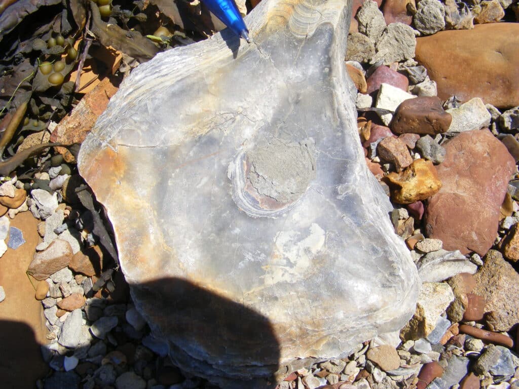
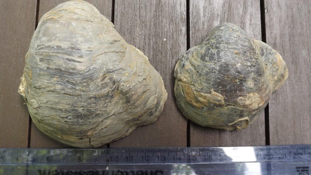
Along the shore at Ferry Bridge Kimmeridge Clay is seen with many fossils especially Ostrea delta as seen in the picture below. These might look like modern oysters but they are fossils and this can be established by feeling their density (relative weight) compared with modern shells which are much lighter. The fossils have been mineralised and any pore spaces are filled with mineral material (calcite) where-as modern shells might be quite porous.
Accessing the Fleet shore is potentially hazardous as there are areas of mud and weed especially in the bays in which you can sink, so keep to the footpaths. There is a footpath along much of the coast between Ferry Bridge and Langton Herring but after that it is necessary to take the inland diversion around the Ilchester Estate land between Rodden Hive andAbbotsbury. Parts of the Fleet shore are accessible with permission from the Fleet Nature Reserve warden at 01305 760579 or e-mail [email protected]. Interesting boat trips can be taken in a glass bottom boat along parts of the Fleet. Visit the Ferry Bridge Centre for details.
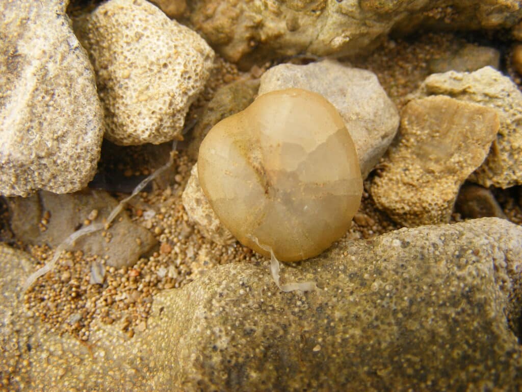
After the Kimmeridge Clay, the rocks change to the Corallian,a mixture of sandstone, clay and limestone and the best section is just south of Camp Road in Wyke Regis. Here the oolitic limestone of the Osmington Oolite is again seen. Occasional small echinoids (Nucleolites) can be found weathered from the limestone. They look similar to a flattened pebble but have delicate ornamentation on the shells. Theechinoids lived buried the sediment so when they died there was more chance that they would be preserved as they were already buried! Sometimes the shell is lost and the infill of crystalline calcite is found as seen in the picture below. Other fossils found are mainly trace fossils with vertical burrows termed Skolithos.
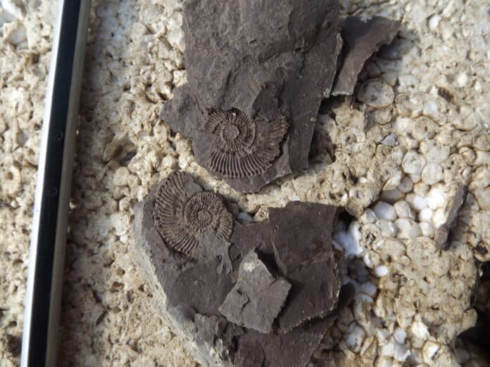
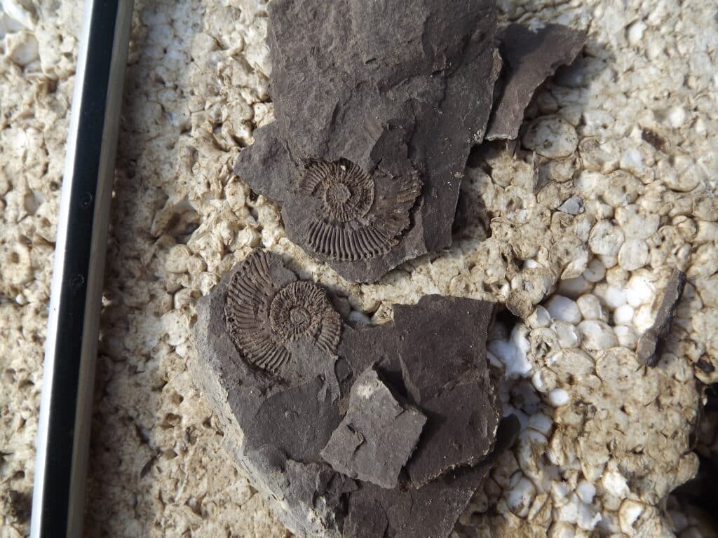
Moving north from Camp Road you have to move in land because of the Army Bridging Camp. However moving north into Lynch Cove and Tidmoor Cove the Oxford Clay is exposed and if the cover of eel grass is not too great you might find small pyritised ammonites. These can be very small so you may need to go on hands and knees to find them.The Oxford Clay was deposited in deeper water than the Corallian seen earlier which was largely formed in shallow coastal waters but still marine

However the most common fossil is the oyster Gryphaeawhich is rather more obvious.
The next obvious feature along the Fleet shore is Tidmoor Point which has the complication of the Army firing range. When firing is not taking place it is possible to walk along the shore but if firing is taking place there is a diversion in land to reach the shore again at Chickerell Hive Point. Tidmoor Point also exposes Oxford Clay and ammonites and fragments of Pentacrinus can be found (star shaped fragments of crinoids which are related to starfish and sea urchins). The clay is slumped in the low ‘cliffs’ but it is better to search the beach where the fossils occur having been washed out of the clay. The Oxford Clay is exposed in the cove north of Tidmoor Point where it is thinly bedded shale and the fossils are flattened casts of ammonites rather than being preserved in pyrite. This contrasts with the more massive mudstone seen previously. This horizon is also seen in the SSSI of Crook HillBrick Pit which is next to the Weymouth and Portland Borough Council depot. The brick works at Crook Hill was active until 1969, which was the last operational brick works in Weymouth.
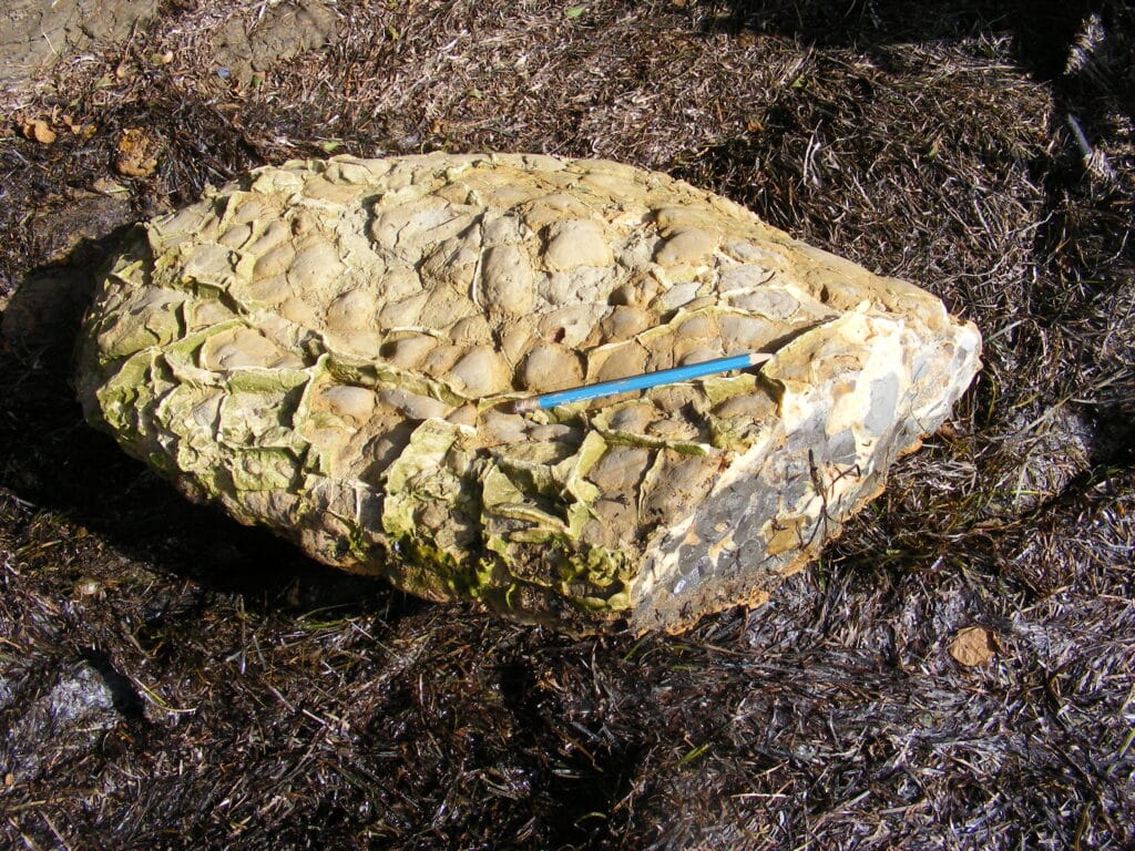
Large concretions (septarian nodules) can also be seen washed out from the clay and exposed on the beach. These commonly occur in Jurassic clay horizons (Oxford and Kimmeridge Clay).
Join us in helping to bring reality and decency back by SUBSCRIBING to our Youtube channel: https://www.youtube.com/channel/UCQ1Ll1ylCg8U19AhNl-NoTg SUPPORTING US where you can: Award Winning Independent Citizen Media Needs Your Help. PLEASE SUPPORT US FOR JUST £2 A MONTH https://dorseteye.com/donate/

