
Continuing north on the coastal footpath the next major feature you reach is Butterstreet Cove. This can also be reached from Fleet Lane which leaves the B3157 on the west side of Chickerell. Butterstreet Cove exposes the next older rock in the succession of Jurassic rocks along the Fleet and this is the Cornbrash. The term is derived from the fact that the rock weathers to produce a stony (brashy) soil suitable for growing cereals. The rock is an impure limestone and in places is very fossiliferous but not in Butterstreet Cove. Further east, in Radipole, abundant brachiopod fossils have been found in temporary exposures (electricity sub-station)and also weathered out in garden soils (personal experience in Icen Road!). The exposures on the Fleet Shore at Butterstreet Cove shows good honeycomb weathering where some of the rock is more easily weathered and eroded and hollows develop. This is quite an exposed position so weathering readily occurs.
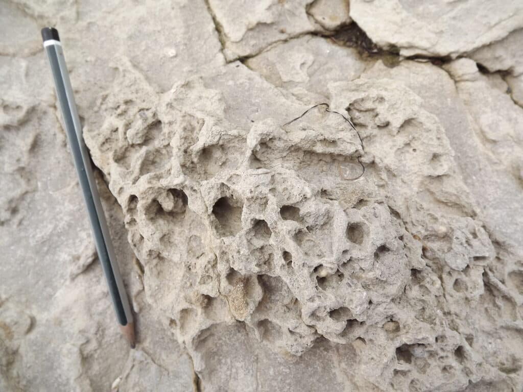
The rock does contain some bivalves as well as trace fossils where creatures burrowed through the sediment when it was first deposited.
If you look carefully at the beach sediment you will see rounded pebbles (if it is not covered in eel grass).
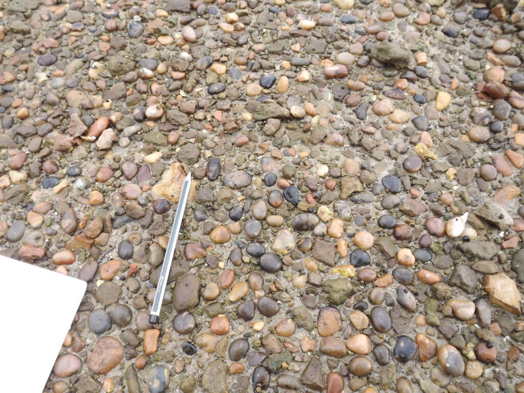
These contrast markedly with the normal angular pebbles found on much of the Fleet Shore. My personal view is that the rounded pebbles might have been carried from Chesil Beach in the severe storm on 22/23 November 1824 which caused great loss of life and property along the Dorset Coast.The church at East Fleet was badly damaged and the church at Butterstreet Cove is the refurbished remains.
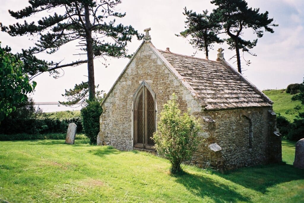
A new church was built which can be seen further up Fleet Lane towards Moonfleet. See Ian West’s website for more details at http://www.southampton.ac.uk/~imw/chestorm.htm
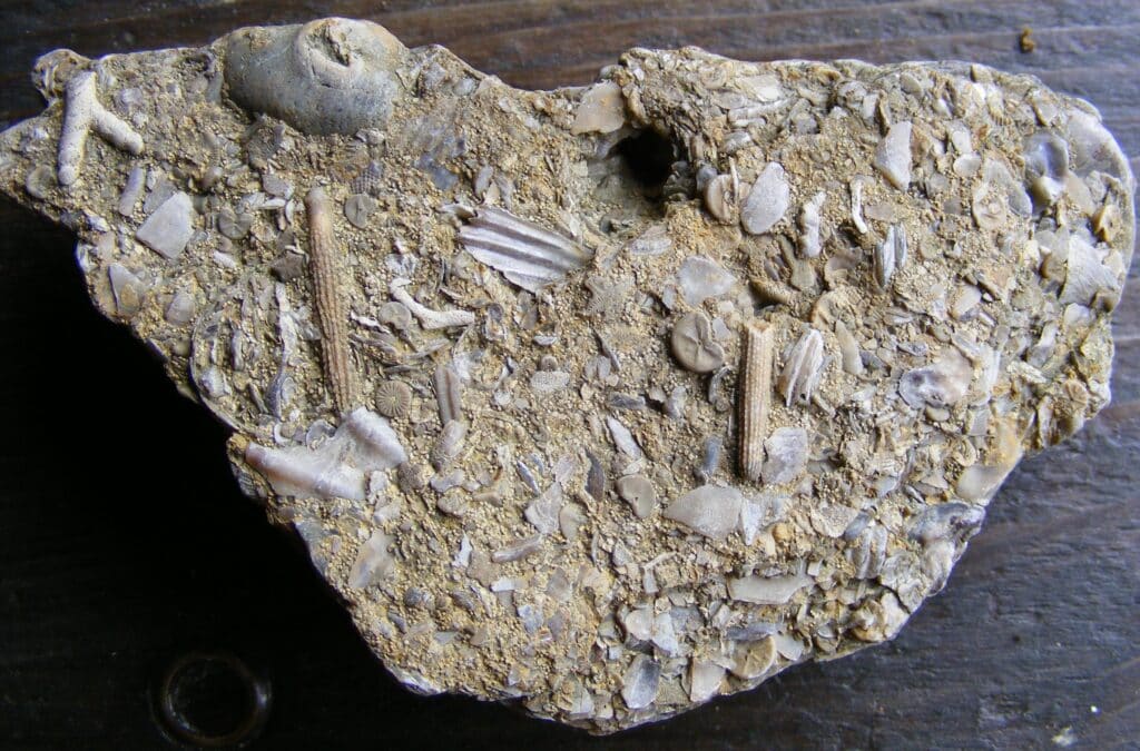
Moving further north along the coastal footpath, the next place of interest is Moonfleet where the next rock unit lower down the Jurassic succession is seen. This is the Forest Marble, a very fossiliferous limestone (not a marble in the geological sense but a limestone that can be cut and polished). The name Forest Marble comes from the place it was studied called the Forest of Wychwood in Oxfordshire. As mentioned in the last instalment parts of the Fleet Shore are managed by the Fleet Nature Reserve warden at 01305 760579 or e-mail [email protected]. and access permission should be sought. The picture below shows a piece of the Forest Marble with fragments of shells, mostly bivalves, crinoid ossicles and echinoid (sea urchin) spines. The specimen is around 8 cm across. The sediment was formed in a shallow water, high energy environment hence the fauna, when it died, was move about and broken up by wave or current action. Careful observation of the rock shows that it can be oolitic, another sign of its formation in shallow water. Forest Marble is a very useful building stone and has been used for flooring and damp proof courses in historical times because it is impermeable (water will not pass through it) because of the layers of shells. It has also been used for drystone walling because it occurs in relatively thin beds.
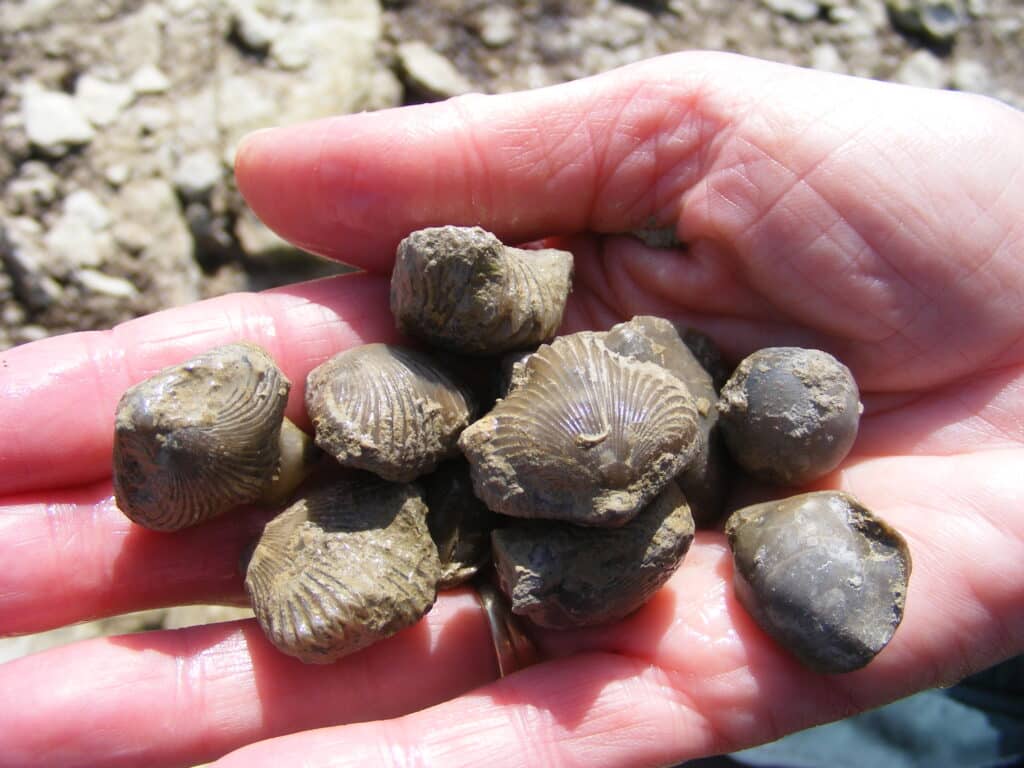
The next location of interest is Herbury where the Forest Marble gives way to the Fuller’s Earth Clay (Frome Clay). Here again access is limited by the land owner unfortunately but in the past many fossil brachiopods (Rhynchonella boueti) could be collected from the Boueti Bed which is exposed on the NW corner of the Herbury Peninsula. The ribbed Rhynchonella are very common but smooth shelled Terebratula also occur as seen in the picture below.
Moving further north along the Fleet the next area of interest is a Langton Hive Point which can also be reached via the village of Langton Herring. A low cliff at Langton Hive Point exposes the Fullers Earth Clay (Frome Clay) with an oyster bed made of Praeexogyra (Ostrea) hebridica in enormous numbers (picture below). A similar oyster bed can be seen in the West Bay area. The Fullers Earth Clay is the oldest rock in the immediate area in the centre of the Weymouth Anticline (dome shaped fold).
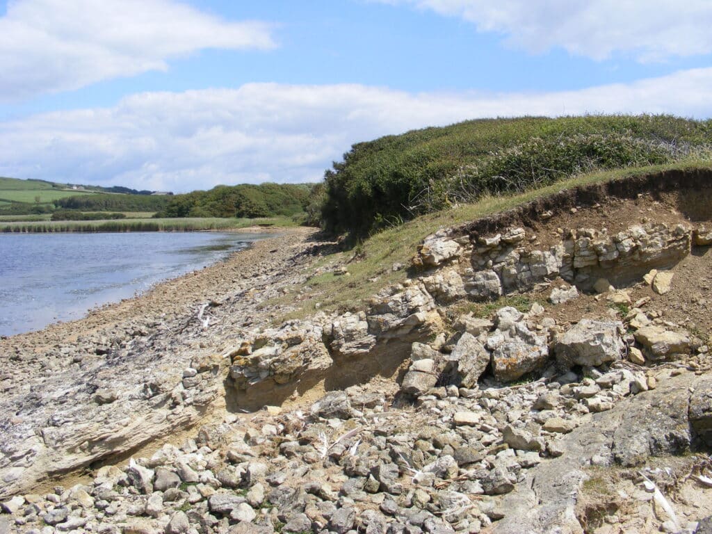
Moving north again it is not possible to continue along the Fleet and the footpath goes inland as access through the Ilchester Estate land is limited. However the geology is repeated as you work north on the north side of the anticline. The view below is the Cornbrash at Shipmoor Point, just south of Abbotsbury. The bedding and the dip of the strata are clear and the land falls away in the distance on the Oxford Clay.
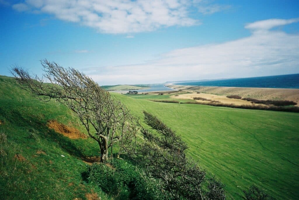
The picture below is the view looking south east along the Fleet from the end of the lane past the Sub-tropical Gardens at Abbotsbury. It shows the beautiful sweep of Chesil Beach with Portland in the distance.
Join us in helping to bring reality and decency back by SUBSCRIBING to our Youtube channel: https://www.youtube.com/channel/UCQ1Ll1ylCg8U19AhNl-NoTg SUPPORTING US where you can: Award Winning Independent Citizen Media Needs Your Help. PLEASE SUPPORT US FOR JUST £2 A MONTH https://dorseteye.com/donate/


