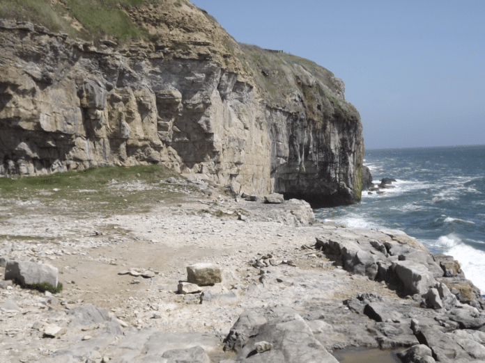
All the rocks in Dorset are sedimentary and were deposited in water, mostly in shallow seas. They were deposited during the Jurassic, Cretaceous and Tertiary between about 200 million years ago and 40 million years ago and vary considerably in hardness and therefore resistance to erosion. This is well displayed on the Isle of Purbeck between Studland and Lulworth. The first article in the series showed how the coast at Ballard Down with Old Harry sticks out into Poole Bay because Chalk is relatively harder than the rocks to the north in Studland Bay (Tertiary sands and clays) and south in Swanage Bay (Cretaceous sands and clays). Overall the rocks here dip gently to the north and get younger from south (Durlston Head) to north (Studland Bay). Durlston Head is formed of relatively hard Portland Limestone but moving north into Durlston Bay the rock changes to the Purbeck Beds made of beds of limestone but also many beds of clay between the layers of limestone. As a result they are more easily eroded and can be affected by slumping as occurred in 2001. Peveril Point forms a promontory because the Purbeck Beds here contain more limestone and less clay.
Durlston Head, harder Portland Limestone
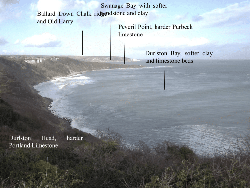
In between Ballard Down and Peveril Point is Swanage Bay and the soft Cretaceous sandstone and clay beds are easily eroded. In the view below the Purbeck Beds exposed in Durlston Bay are seen and there is evidence of past landslips including some subsequent coastal protection. The dip of the strata to the north is also apparent.
Landslip which occurred in during the wet winter of 2000/2001
Coastal protection put in place after a landslip in the 1980s
The coastal section between Durlston Head and Studland Bay is a classic example of a headland and bay coastline and occurs because the coast cuts across the arrangement of the rock strata at approximately 90o (transverse coastline). This contrasts with the coast west of Durlston Head where the strata (rock layers) are parallel to the coast.
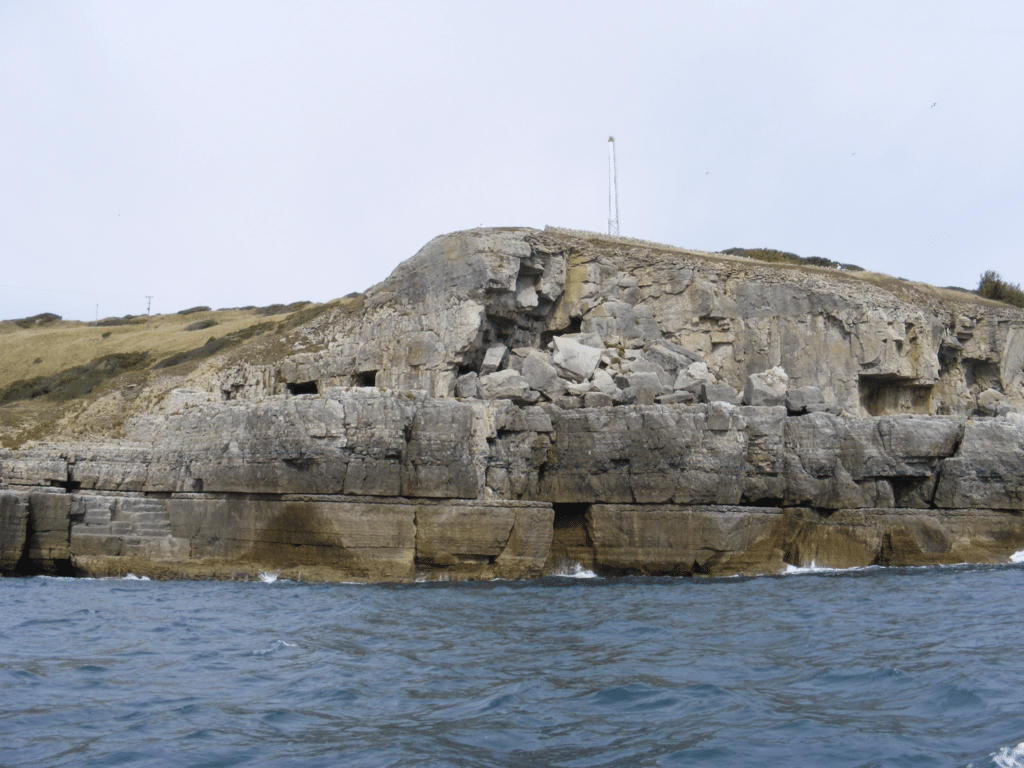
Working south and west, on reaching Durlston Head the coast changes orientation and runs east west and the stronger Portland Limestone forms well developed cliffs which can be seen through to St Aldhelm’s Head. In the past the limestone was quarried along this section of coast as seen at Tilly Whim Caves and Dancing Ledge. The view below shows the Tilly Whim Caves coast from the sea. The adits from which the stone was removed during quarrying (mining) can be seen. The stone would have been lowered onto barges and taken to Swanage before being transported on to where it was going to be used. The vertical cliffs are a good indication of a fairly strong rock. Wave action during storms may well cause erosion (hydraulic action) but it is a relatively slow process compared with the erosion of the weaker cliffs in Durlston Bay and Swanage Bay. This was a major problem in 2011 and 2012 between Swanage and Ballard Down.
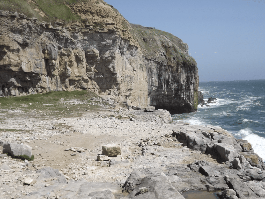
The picture below shows the coast at Dancing Ledge where the Portland Limestone is also seen.
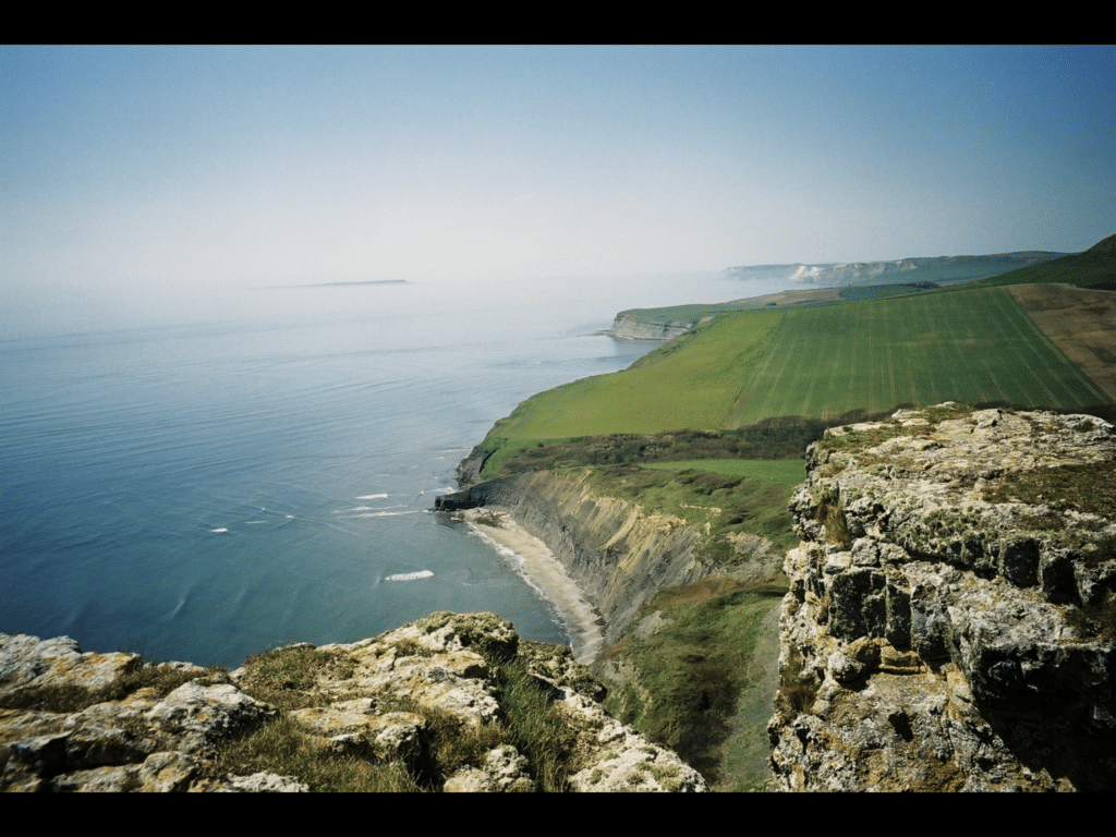
Further west the Portland Limestone gives way to Kimmeridge Clay, the next rock type down (older) and this is weaker so the coast cuts northwards to form Chapman’s Pool and the lower lying coast as far as Kimmeridge. There are high points such as Swyre Head and Houns-tout where the Portland Limestone caps the clay. All this is accessible from the South West Coast Path either from Swanage, Worth Matravers or from Kimmeridge and is well worth an excursion. The walking is a bit challenging in places but mostly fairly gentle. If you go to St Aldhelm’s Head make sure you visit the chapel made of local stone. The view below is taken at Houns-tout looking west towards Kimmeridge and Lulworth with Portland appearing in the mist in the distance.
Join us in helping to bring reality and decency back by SUBSCRIBING to our Youtube channel: https://www.youtube.com/channel/UCQ1Ll1ylCg8U19AhNl-NoTg SUPPORTING US where you can: Award Winning Independent Citizen Media Needs Your Help. PLEASE SUPPORT US FOR JUST £2 A MONTH https://dorseteye.com/donate/

