
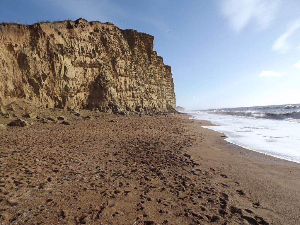
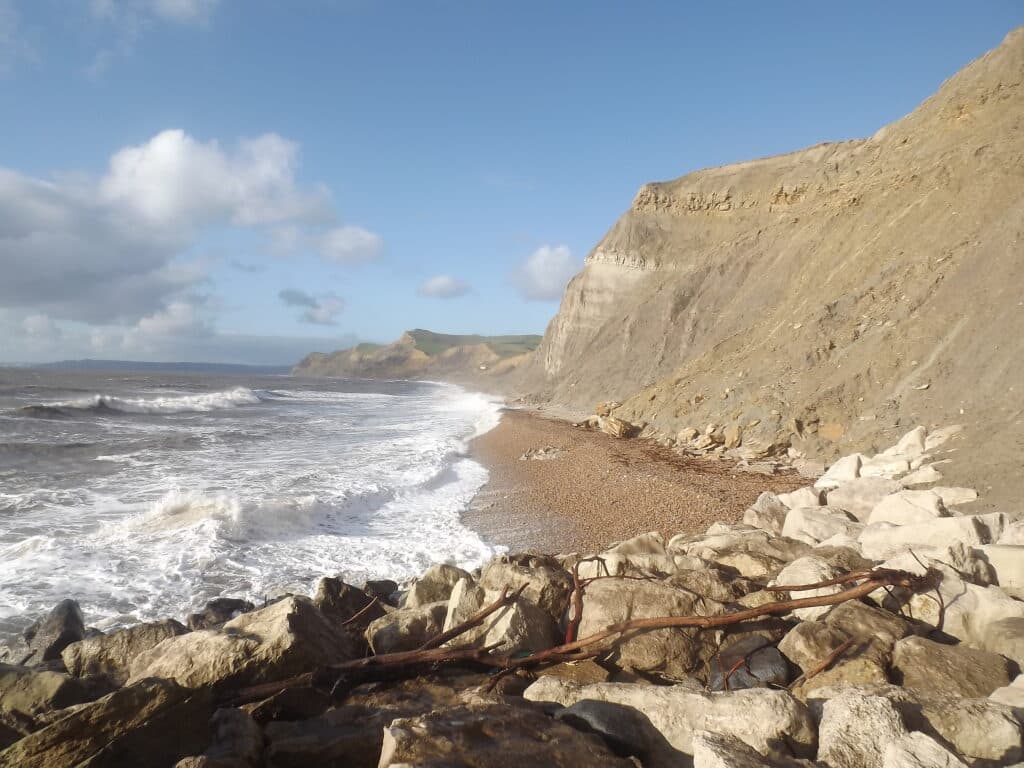
The coast between Freshwater and West Bay Harbour is similar to that at Burton Bradstock with near vertical cliffs of Bridport Sand but lacking the Inferior Oolite and Fullers Earth / Frome Clay capping. Again rock falls are a common hazard and care should be taken and when walking along the beach you should keep well back from the base of the cliff.
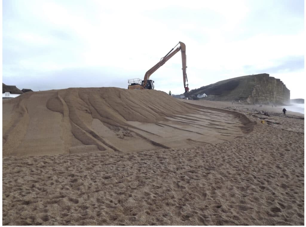
West Bay Harbour marks the NW end of Chesil Beach and you will see the sediment is fine gravel (pea grit) similar to that at Burton Bradstock. As at Chiswell, at the S.E. end of Chesil Beach, beach management is necessary to protect the low-lying land of West Bay along the River Brit seen in the picture below. Routine maintenance is necessary as seen in the second picture below taken on 18th February 2014 after the storm events of early 2014. As this is part of the World Heritage Site of the Jurassic Coast it is not possible to bring in ‘foreign’ material to augment the beach and there is little or no new natural supply coming by longshore drift from the west.

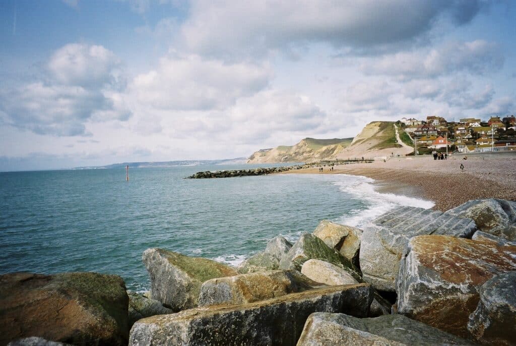
The West Bay section also shows further evidence of human intervention after the major civil engineering works realigning the breakwaters of the harbour to allow safer access for boats and reduce danger of storm damage. The picture below was taken in 1999 with the old breakwaters and the next one down taken in January 2015 after construction work was completed in 2005.


Not only were the harbour breakwaters realigned but rock armour groynes were put in place to limit loss of beach sediment which helps to absorb wave energy.
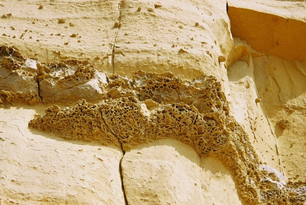
East Cliff at West Bay is formed of Bridport Sand. The weathering of the sandstone is obvious with the harder and softer bands but also honeycomb weathering possibly picking out burrows that were made by organisms when the sand was deposited on the sea floor in Jurassic times.
At West Bay the geology is complicated by faults. Frome Clay and shelly Forest Marble are down faulted and occur at sea level immediately to the west of West Bay promenade.
A second fault places the Forest Marble next to the Middle Lias Downcliff Clay and Thorncombe Sand. This second fault is exposed in what is known as Fault Corner and the fault plane is obvious as a diagonal flat surface.

Blocks of very fossiliferous shelly Forest Marble can be found on the beach and the picture below shows shell debris and a black fish tooth in the middle lower half.

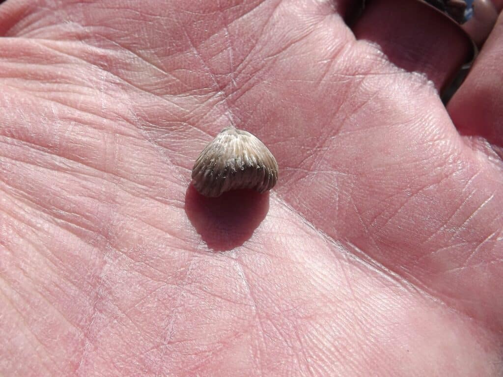
Further west at Eype, which can be reached by a minor road off the A35, another fault affects the geology. The coastal section between West Bay and Eype is dominated by sandstone and clay units of the Middle Lias (Lower Jurassic). Fossils can be found, both body fossils, i.e. the actual shells, and trace fossils (burrows where creatures such as crustaceans and worms have been). Below you can see a typical brachiopod found in the section.
Alan Holiday
PLEASE SUPPORT US FOR JUST £2 A MONTH


