
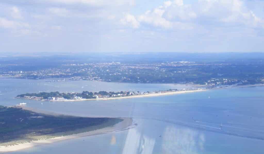
The rocks seen on this section can be seen by walking from Poole Head eastwards. The Sandbanks area has no exposure due to buildings and the underlying geology is Palaeogene (Tertiary) Parkstone Clay. The aerial picture below shows the Sandbanks Peninsula the Studland Peninsula and Shell Bay in the foreground. The low lying nature of the land in apparent.
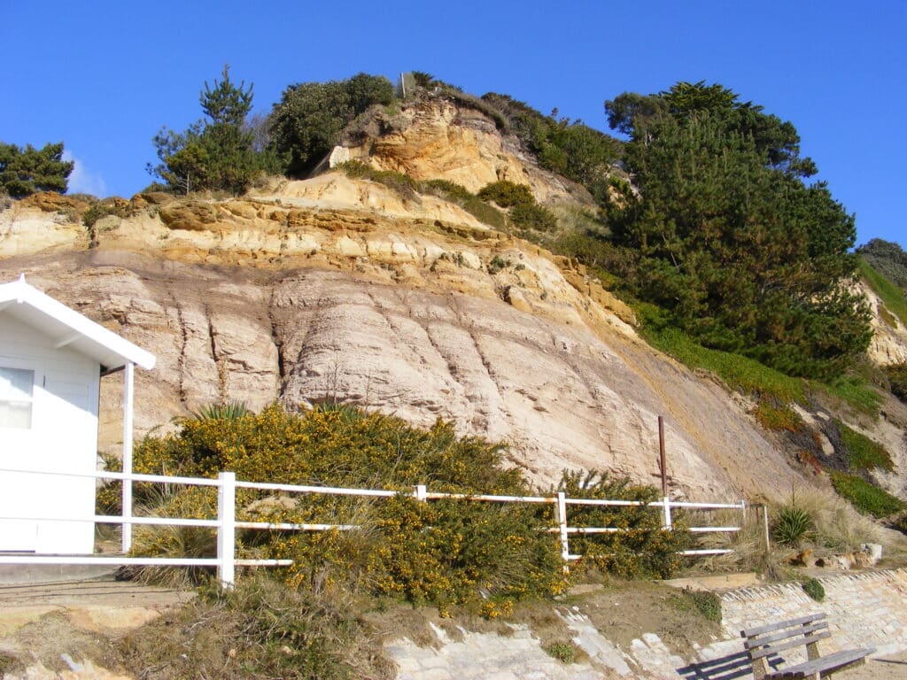
From Poole Head eastwards the rocks (strata) dip gently to the east so the rocks get younger as you walk towards Bournemouth. The rocks are 40-45 million years old. The rock that dominates this coastal section is the Branksome Sand with the Boscombe Sand appearing at the eastern end by Bournemouth Pier. The rocks arevery soft and poorly consolidated or cemented and so cliff falls can occur and if it was not for the sea wall providing coastal defence, the land above the beach would be in even more significant danger. The picture below shows a rock fall in the Branksome Dene Chine area in February 2009. Evidence of the softness of the sands can be seen with the deeply eroded valleys or chines. Vegetation, both natural and planted helps to hold the cliffs in place but in wet periods this is not enough to prevent cliff falls especially in prolonged wet weather. The second picture below also helps to show how soft the sandstone is because water running over the surface has left gullies in the cliff face

Above the sands is a layer of much younger gravel (Pleistocene between 10,000-2 million years old) that was deposited by a river system which drained the area. The deeply eroded chines were mentioned earlier in this episode. The erosion of the cliffs in the past, when they were further out in Poole Bay, meant that streams cut down rapidly to reach base level. This might have been when the climate was wetter than now (is that possible!) and there was a lot of drainage water running south to what is known as the Solent River which flowed through the area between Hampshire and the Isle of Wight.
The Branksome Sand was also deposited by a river system which flowed from west to east but much earlier as mentioned at the beginning of this episode. Evidence of this can be seen across Dorset. In the west e.g. Hardy Monument, near Portesham,there are coarse gravels but working east the sediment becomes finer and there are sands and gravels in the Wareham Heath area and sands on Brownsea Island and along the Poole and Bournemouth section. Some are estuarine and then further east beyond Christchurch to sediment changes to marine clays e.g. at Barton on Sea.Within the Branksome Sand there are some thin clay beds and these contain some pant fossils which provide evidence of the climate at the time which was tropical / sub-tropical. Nipa palm leaves have been found and these now grow in S.E. Asia (Vietnam).
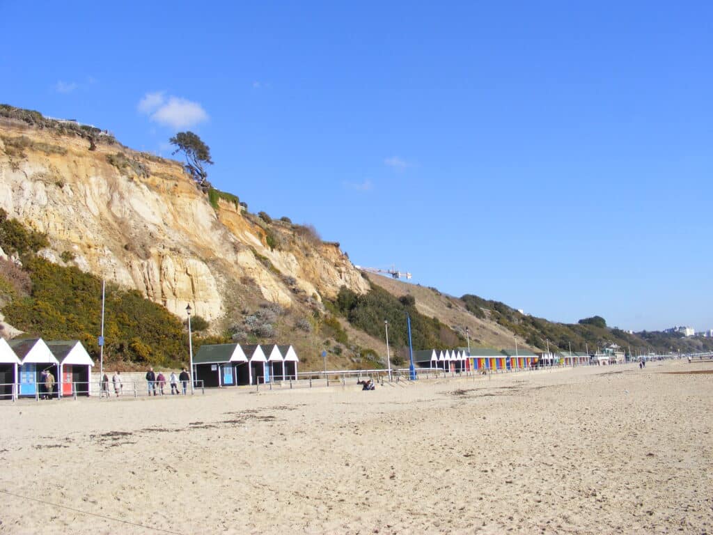
Further east the geology is less well exposed due to vegetation cover as can be seen in the picture below. The second picture is east of Bournemouth Pier and again vegetation covers much of the sand, in this case the Boscombe Sand.

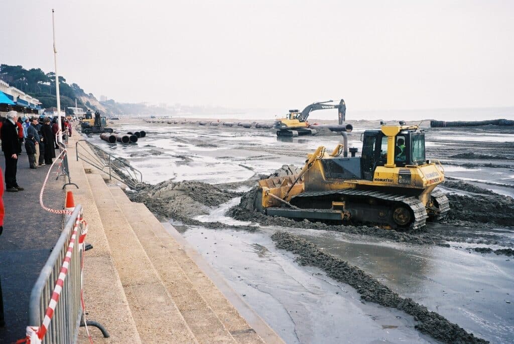
The coast has to be constantly managed and in the last 10 years or so there have been a number of projects to protect the Poole section. This includes the building of new groynes and beach replenishment schemes. The picture below shows beach replenishment in January 2006 using sediment dredged from Poole Harbour.
.
Alan Holiday
PLEASE SUPPORT US FOR JUST £2 A MONTH


