
Another good location to see Gad Cliff is from WorbarrowTout which is accessible from Tynham, the abandoned village between Kimmeridge and Lulworth. It lies within the Lulworth Army Firing Range and was evacuated during the Second World War for defence training purposes and has remained empty ever since. However, it is possible to visit when the ranges are open (most weekends and school holidays). The church and primary school have been preserved and are open to the public and the friends of Tynham have created a museum which shows what life was like in the village before the WWII. The village is definitely worth a visit and then you can walk along a flat track for just over 1 km. to reach Worbarrow Bay.
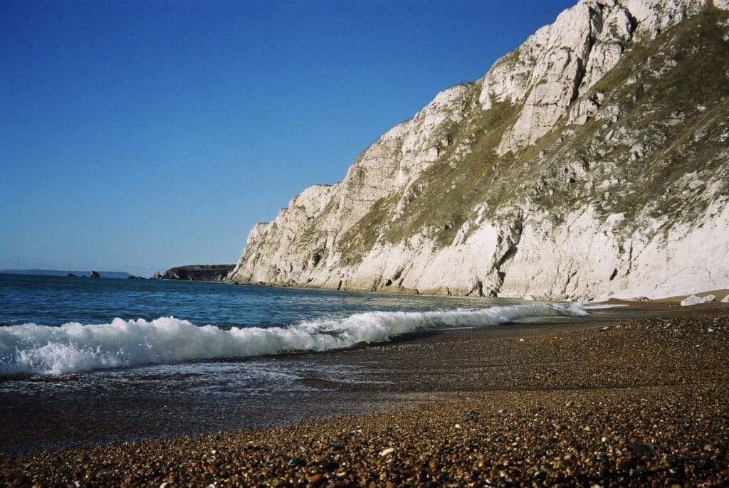
On reaching Worbarrow Bay it is worth climbing the steep path to the top of Worbarrow Tout to view the coast to the east and west. To the east on a clear day you will be able to see Gad Cliff, Kimmeridge and round as far as St Aldhelm’sHead. The contrast in the geology is obvious with the dark grey clay lower cliffs at Kimmeridge and the higher cliffs of St Aldhelm’s Head and Gad Cliff built of Portland Stone.
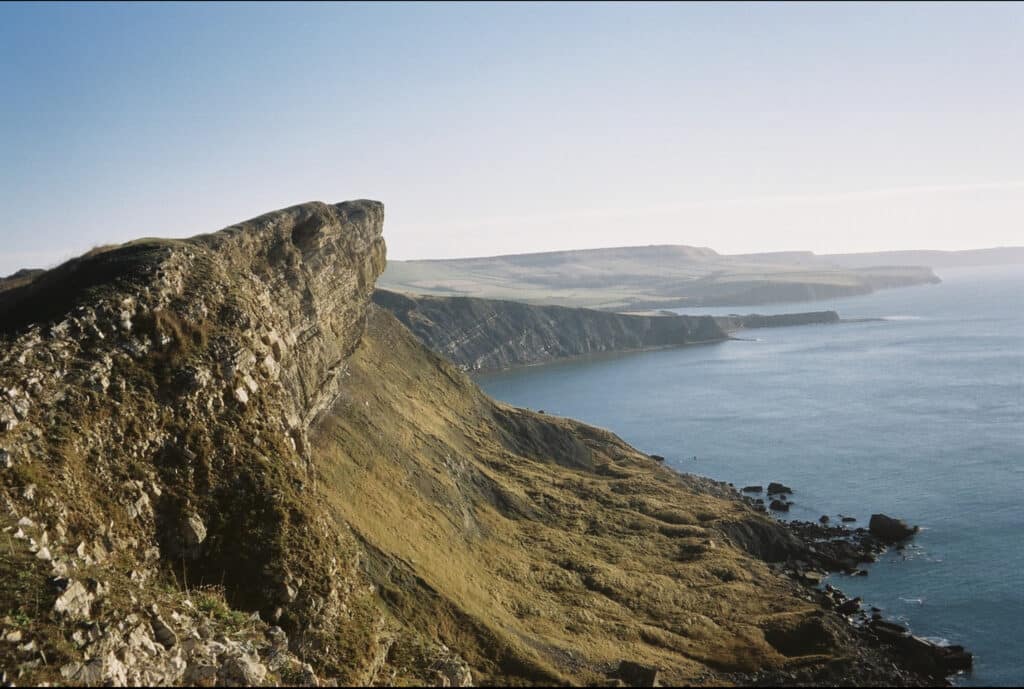
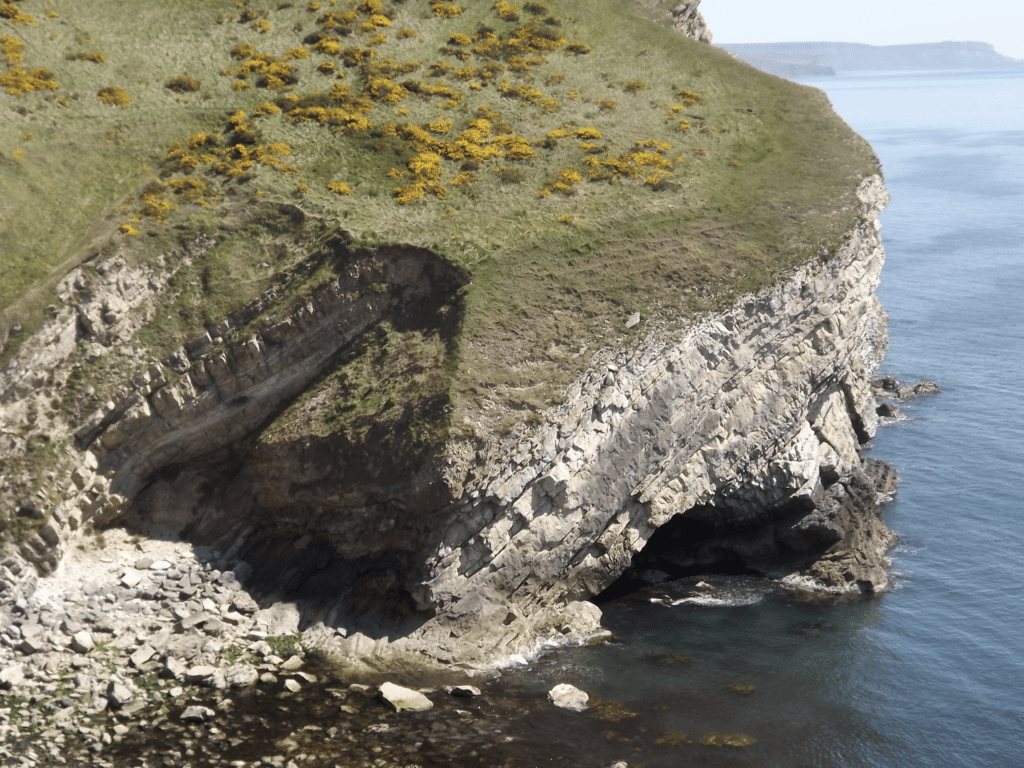
Between Gad Cliff and Worbarrow Tout is Pondfield Cove, where the Portland Limestone and the Purbeck Beds can be seen. The entrance to the cove is formed of stronger Portland Limestone but once this had been broken through the weaker Purbeck Beds with thinner limestone and clay beds have been more easily eroded. In the picture below looking east from Worbarrow Tout the Portland Stone has been eroded at sea level to form a cave where fractures (joints) have been exploited. Above are the more thinly bedded Purbeck Beds.
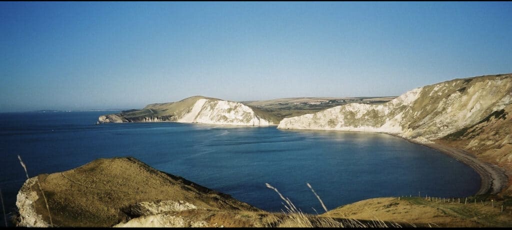
Worbarrow Bay (including Pondfield Cove) is a really special place on the Jurassic Coast as it is relatively unspoilt (except for constantly accumulating jetsam, mostly plastic, washed infrom the sea!). It is undeveloped because it is centrally located within the Lulworth Ranges. Rocks ranging in age from 145 million years old (Portland Limestone) to 70 million years old (Chalk) can be seen across the broad sweep of the bay.
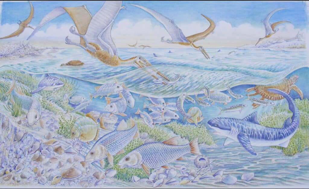
During this time conditions changed from shallow sea (Portland Limestone) to an extensive lagoon with the Purbeck Beds. The picture below is an artist’s impression of the lagoon based on fossils found in Dorset (DIGS Purbeck Project).
For the more agile of you a walk along the rocks on the north side of Worbarrow Tout is worth the effort. Beware the rocks are slippery and a low tide is essential. On the west side of the Tout interesting Purbeck Beds are to be seen which are different to those in Pondfield Cove. One of the main differences is the presence of the mineral gypsum in the form of satin spar. When the Purbeck lagoon dried out periodically chemicals dissolved in the water were deposited (precipitated). Gypsum was one of these and rock salt (halite) was another. The picture below shows satin spar so called because it is crystalline and has a satiny lustre.
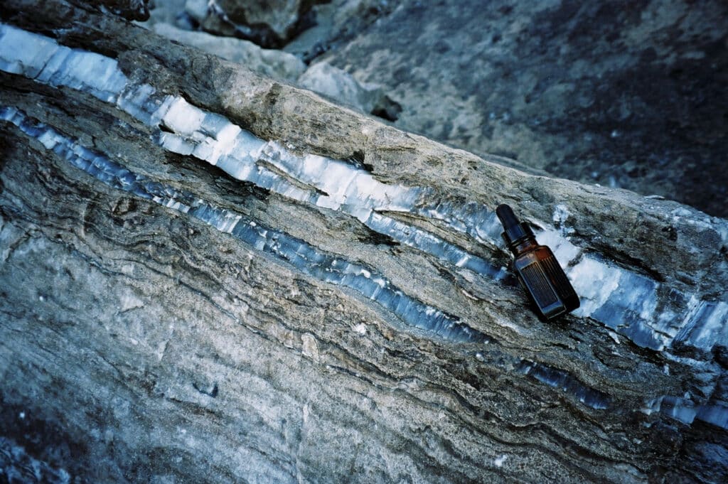
Gypsum is easily recognised as it is very soft and can be scratched with a finger nail unlike calcite and quartz, two other common white or colourless minerals which can’t be scratched so easily. Rock salt is not present as it is so soluble it was dissolved but the cubic crystals were replaced by sediment or other chemicals and salt pseudomorphs can be found.
Later the area became land and the Wealden Beds of the Lower Cretaceous were deposited in rivers and lakes (more of this when we look at Lulworth Cove). Later in the Cretaceous the sea flooded the area again and the Upper Greensand and Chalk were deposited in a deepening sea. So this is a really wonderful location to see a snapshot of the interest that can be seen on the Jurassic Coast World Heritage Site.
As with the coast around Swanage the shape of the coast is controlled by the relative strength of the rocks. Where the Portland Limestone occurs the coast sticks out but once it has been breached the sea quickly erodes the Purbeck and Wealden Beds until the Upper Greensand and Chalk is reach which forms the high cliffs at the back of the bay. This can be clearly seen in the picture below of Cow Corner in the N.E. of Worbarrow Bay.
A range of beds can be seen in Worbarrow Bay because the layers of rock (strata) are dipping to the north and they get younger going from south to north.
There is a noticeable dip in the cliff line at the back of the bay and this is Arish Mell (arrowed in the panorama photograph). The Chalk ridge here has been cut and this was probably the result of erosion by a river in the geological past during a wetter period, possibly during the Pleistocene with water from melting snow and ice.
On the far side of Worbarrow Bay Mupe Rocks can be see which will be part of the next instalment of this survey of the Jurassic Coast.
Join us in helping to bring reality and decency back by SUBSCRIBING to our Youtube channel: https://www.youtube.com/channel/UCQ1Ll1ylCg8U19AhNl-NoTg SUPPORTING US where you can: Award Winning Independent Citizen Media Needs Your Help. PLEASE SUPPORT US FOR JUST £2 A MONTH https://dorseteye.com/donate/


