
The west side of Worbarrow Bay has more of interest. As with Worbarrow Bay mentioned in article 6 it is only accessible during most weekends and school holidays when the Lulworth Ranges are open. The area can be accessed from Lulworth Cove. Walk around the Cove and use the steps on the east side to reach the coastal footpath. Go through the gate into the Firing Range and walk past the Fossil Forest and continue on until you first reach Bacon Hole and then Mupe Bay.
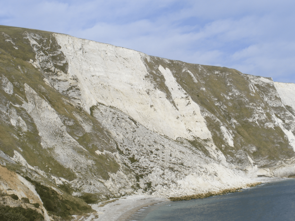
One of the first things you are likely to notice is the remains of a large landslip in the Chalk to your left (north). This occurred in the winter of 2000/2001 which was very wet. The Chalk became saturated and then slumped into the sea.Fortunately it occurred in January and no one was around at the time or even saw it happen I understand.
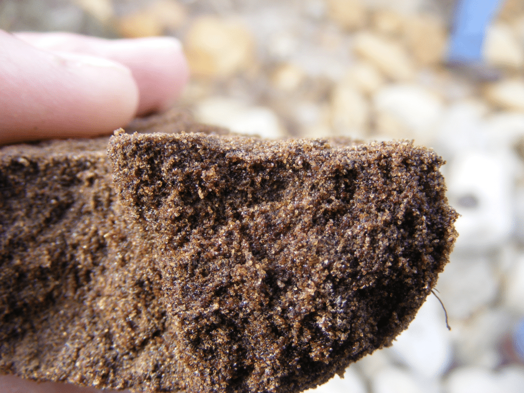
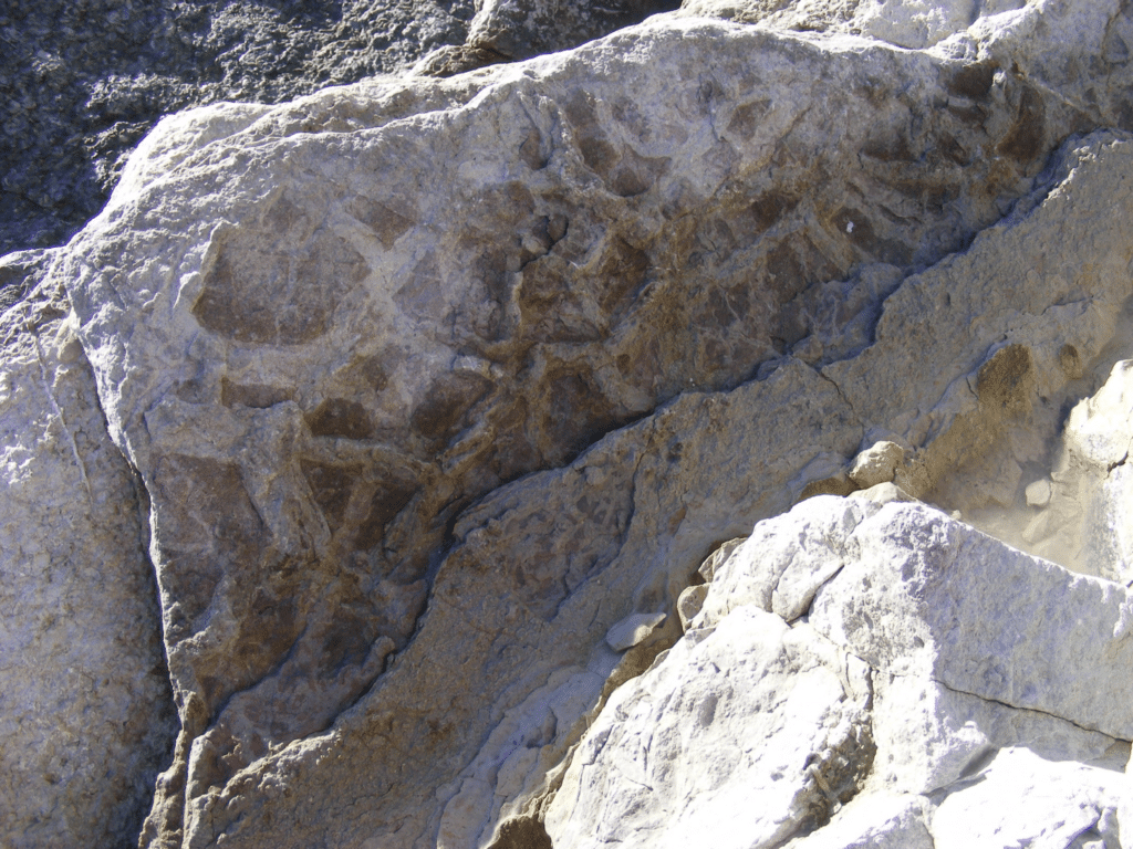
In Mupe Bay the Wealden Beds, Upper Greensand and Chalk can be seen. The Wealden Beds are of interest because one of the sandstone beds contains oily residues from a natural seepof petroleum. It is tarry because the lighter hydrocarbon fractions have evaporated over the years since it was exposed. The picture below shows the sandy rock cemented together with sticky tar.
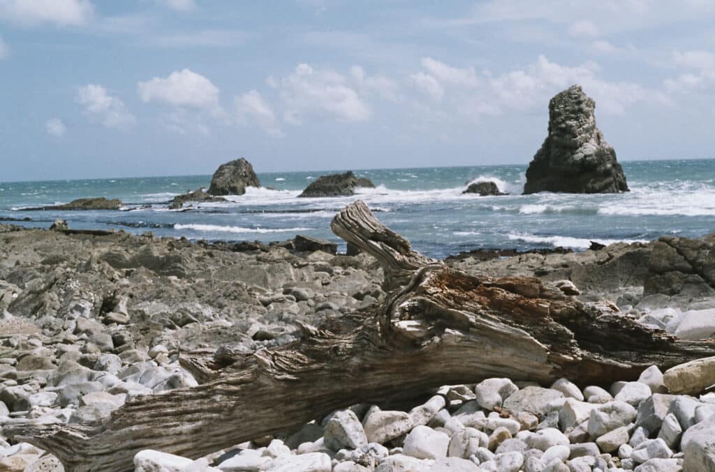
If you walk south (to the right) you will see Mupe Rocks, stacks of Portland and Purbeck Beds, one of which always reminds me of a T. rex coming out of the water!
Splendid views across Worbarrow Bay can often be seen with the Chalk cliffs and Arish Mell to the north and the ledges of more resistant Purbeck Limestone running out to sea. In the picture below Gad Cliff and St Aldhelm’s Head can be seen in the distance. The picture also demonstrates a feature called dip and strike. The dip of a bed is the angle it is inclined from the horizontal, in this case around 26o to the north. The strike is right angles to the dip, in this case east west as are a lot of the rocks in south Dorset.
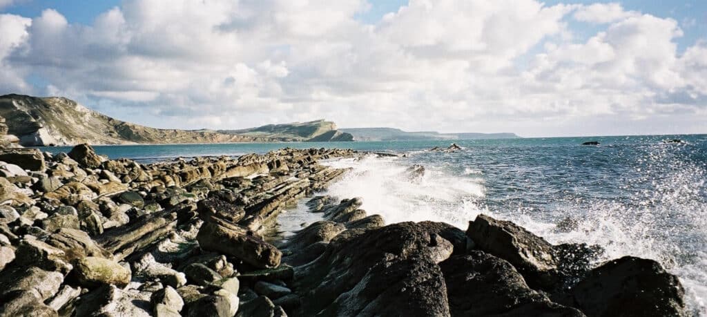
On returning towards Lulworth Cove it is worth stopping at the cliff top above Bacon Hole. Here you get a good view of the stacks of Mupe Rocks. Bacon Hole is so named because the rocks exposed in the cliffs look like rashers of bacon.
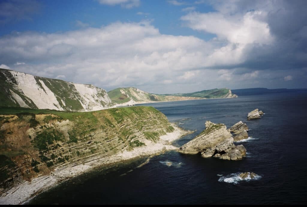
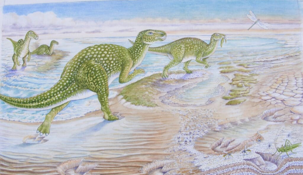
The rock layers (strata) are dipping into the cliff so the rock layers appear to be horizontal (what geologists call the apparent dip as opposed to the true dip into the rock face).The true dip can be seen in the stacks of Mupe Rocks. MupeRocks have survived because the lower part of the seaward side is made of relatively strong Portland Limestone (thicker, more massive beds). However, the upper part of the stacks and the cliffs of Bacon Hole are made of the weaker more thinly bedded Purbeck Beds. If you have time to walk along the beach in Bacon Hole reached from Mupe Bay there are many interesting things to see including mud cracks. These formed in the Purbeck Lagoon when the water evaporated to expose mud flats. As the mud dried it cracked and later the cracks were filled with new sediment which is slightly harder and stands out.
The picture below shows and artist’s impression of the environment at the time and the mud cracks can be seen near the right hand margin. (DIGS Purbeck Project).
The next instalment focuses on the Fossil Forest east of Lulworth Cove.
Join us in helping to bring reality and decency back by SUBSCRIBING to our Youtube channel: https://www.youtube.com/channel/UCQ1Ll1ylCg8U19AhNl-NoTg SUPPORTING US where you can: Award Winning Independent Citizen Media Needs Your Help. PLEASE SUPPORT US FOR JUST £2 A MONTH https://dorseteye.com/donate/


