
Returning from Bacon Hole to Lulworth Cove there are steps down to the famous Fossil Forest section. Unfortunately, no trees are still preserved there but you can see where the trees have been. The rocks exposed are the top of the Portland Limestone and the lowest part of the Purbeck Beds and are on the Jurassic – Cretaceous boundary. The massive Portland Limestone beds form the lower part of the cliffs above the sea and then there is a change to the more thinly bedded limestone at the level of the Fossil Forest and above.
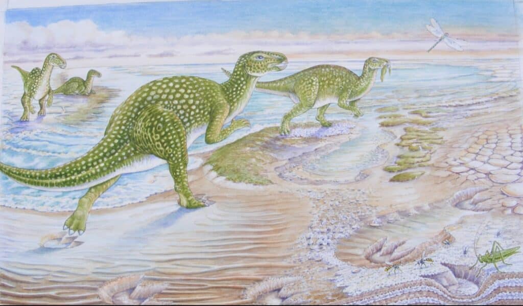
When approaching the site you should not be confused by the content of an information board which shows the scene back 145 million years ago when the rocks were formed. It shows the landscape and vegetation with a dinosaur walking around but also shows a Neanderthal man! Too much artistic licence it would seem! The picture below is a more realistic artist’s impression of the environment at the time (DIGS Purbeck Project).
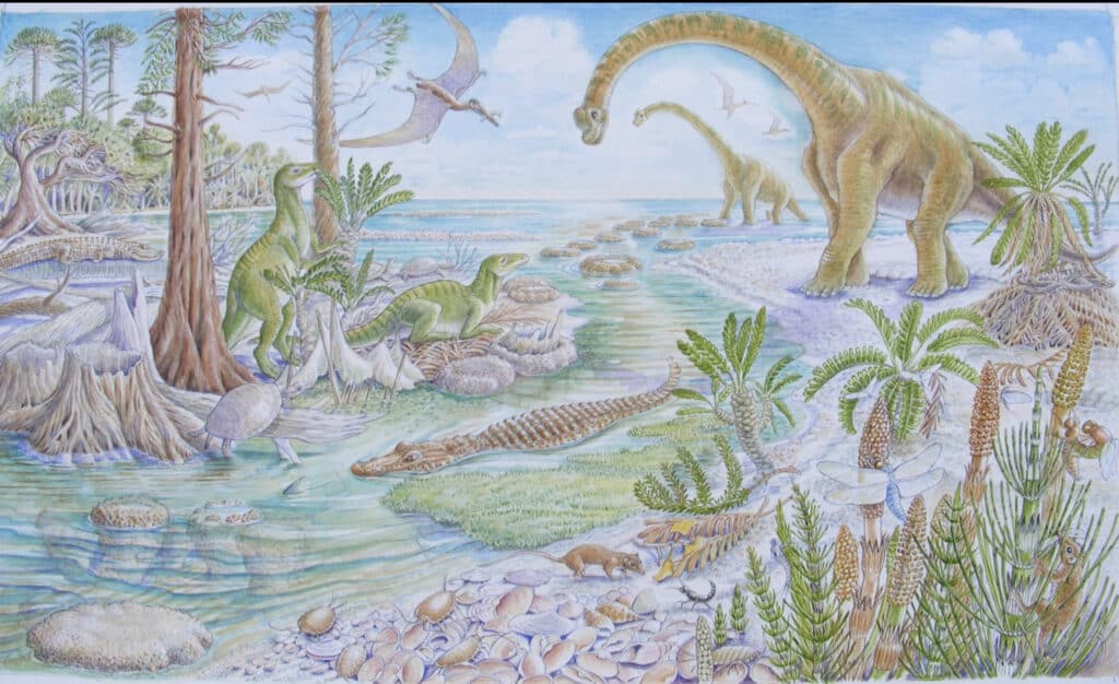
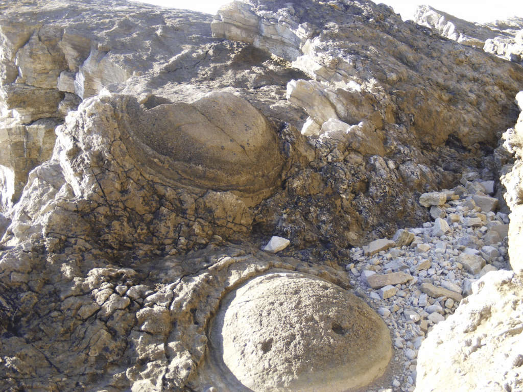
The picture shows the margins of the Purbeck Lagoon where conifer trees were growing. When the water level rose and flooded the wooded area limestone was deposited around the dying tree trunks. This was due to the activity of primitive algae that took calcium carbonate from the water to create the stromatolite rings we see now at the Fossil Forest. A stromatolite mound can be seen in the bottom left hand corner of the picture so they didn’t always form around the trees. The two pictures below show examples of the structures at the Fossil Forest.
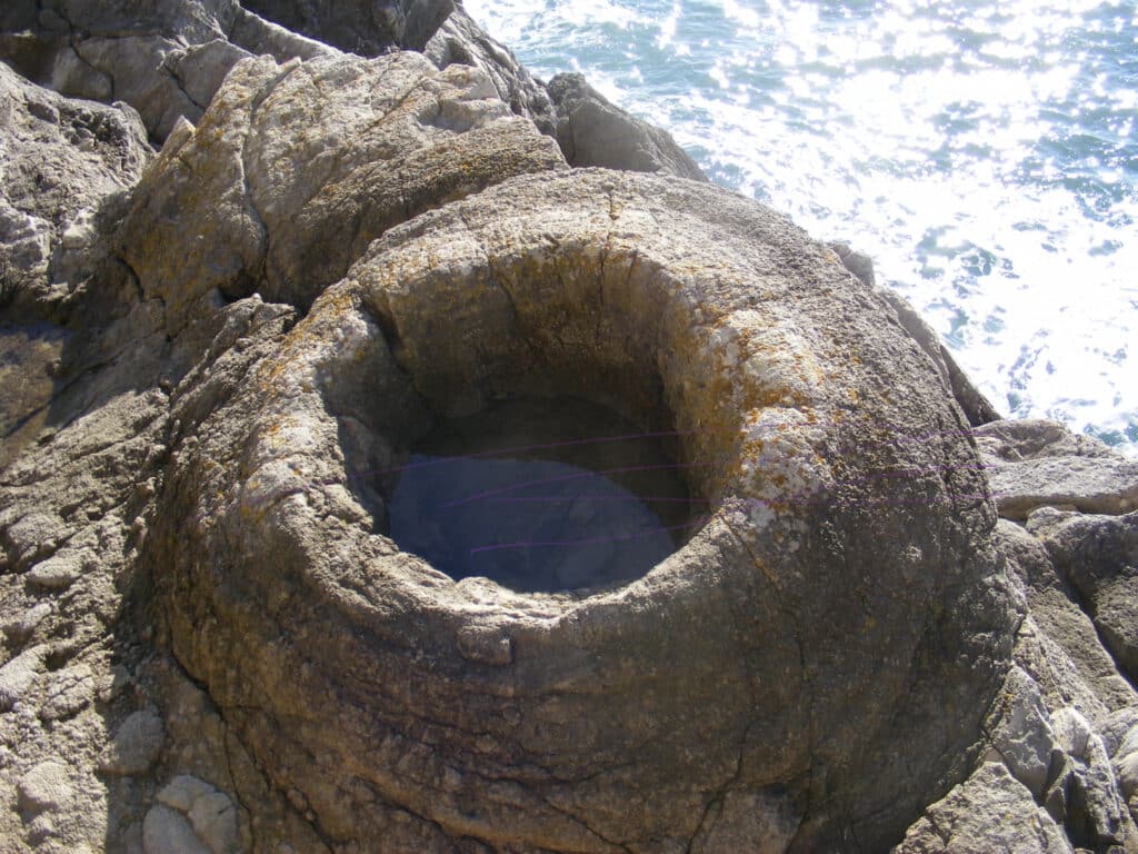
One of the fascinating things is the algae that created these structures have been on the Earth for around 3 billion years. They helped to create our atmosphere by photosynthesis, absorbing carbon dioxide and releasing oxygen. You can see similar structures over 1 billion years old in the Assynt area of Scotland, and in rocks 500 million years old at Durness also in N.W. Scotland. Similar mounds can be seen forming now in Shark Bay and Lake Thetis in Western Australia.
Another interesting feature at the Fossil Forest is the Broken Beds where the thin beds of limestone have been broken up in places to create a chaotic jumble of rock fragments which are now cemented together.
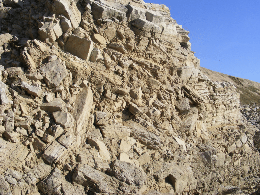
The origin of the Broken Beds is debated but could be due to collapse of the overlying limestone when mineral salts below were dissolved. The minerals were deposited by evaporation of the lagoon water during dry periods. The broken nature is localised and you can walk along the beds from broken and unbroken in a few metres. The presence of the minerals is shown by salt pseudomorphs, the shapes of crystals which have been replaced by sediment, halite or rock salt in the picture below.
The fluctuating water levels at the time when the rocks were deposited is shown by the presence of ripple marks formed in shallow water affected by wave action.
Add pictures of DIGS dried out lagoon and ripple marks in cliff exposure.
Join us in helping to bring reality and decency back by SUBSCRIBING to our Youtube channel: https://www.youtube.com/channel/UCQ1Ll1ylCg8U19AhNl-NoTg SUPPORTING US where you can: Award Winning Independent Citizen Media Needs Your Help. PLEASE SUPPORT US FOR JUST £2 A MONTH https://dorseteye.com/donate/


