
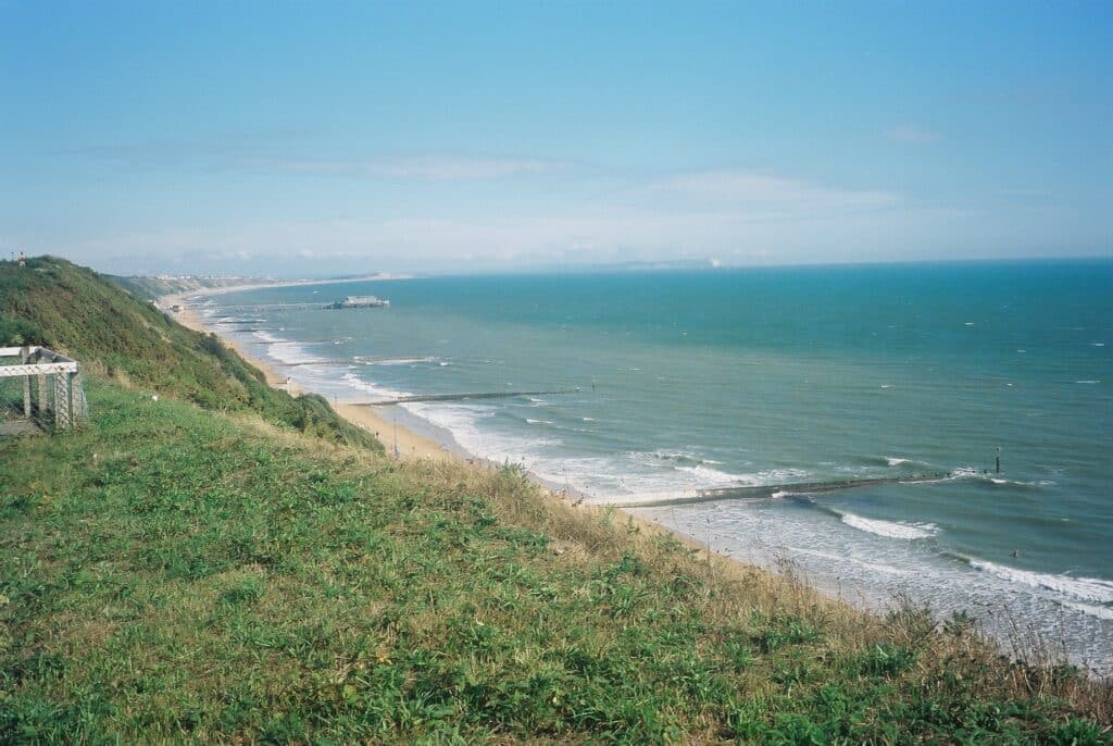
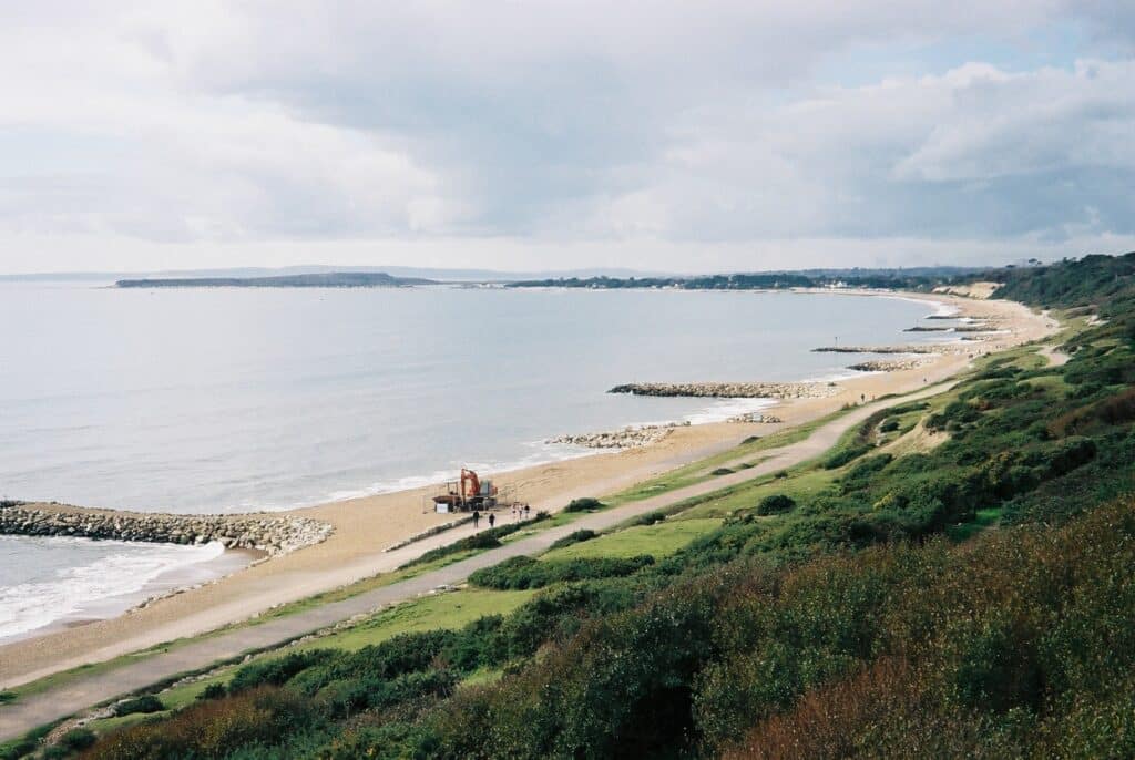
Continuing on from Bournemouth Pier the cliffs are dominated by gently dipping sandstone (rather soft!) of the Boscombe Sand Formation deposited in the Tertiary (Palaeogene) around 40-49 million years ago in a coastal environment with beaches and barrier islands. The exposure is not too good owing to vegetation cover. The view below is looking east and you can see the coast along to Hengistbury Head and also the Isle of Wight in the distant with the Chalk cliffs that for the Needles. Another feature visible is evidence of long-shore drift where beach sediment is moved by wave and current action and in this case from west to east (right to left) with the sand building up on the right hand side of each groyne (as you look out to sea).
The sandstone is a fine quartz sand with some flint pebbles (derived from the erosion of the Chalk. The top of the cliff is capped by much more recent gravels deposited during the Pleistocene (the last 2 million years). Landslips occur periodically particularly after wet weather as seen in the recent picture below taken by Mike Bowler.

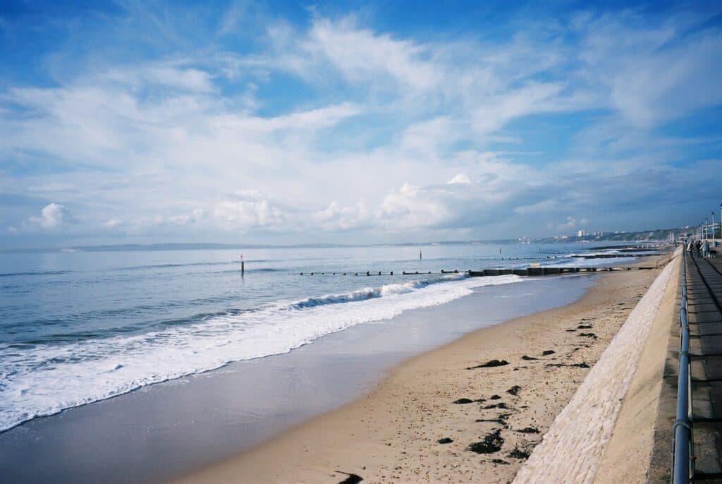
The view below is taken at Southbourne and shows similar features on the beach but the low cliffs along the sea front to Bournemouth and Poole are visible as well as the Chalk cliffs at Old Harry.
At Southbourne little of the geology can be seen as the area is built up and the soft rock has been eroded and the British Geological Survey records Pleistocene blown sand. This could have been derived from glacial moraine deposits over more northern parts of the UK and winds blew outwards from the ice cover picking up fine sand and depositing further south well away from the glacier ice cover.
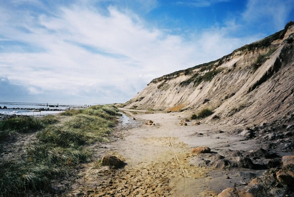
East of Southbourne you reach Hengistbury Head where there is good exposure of the rock with the Boscombe Sand being capped by the Barton Clay Formation. The picture below shows the degraded cliffs of Hengistbury Head. The sandy sediment is not well cemented so is easily eroded. Within the sequence are ironstone nodules up to 1 metre across and in the mid19th C these were worked as an iron ore. They were loaded onto barges, transported to Southampton from where they were shipped to South Wales. The removal of many nodules at beach level would have allowed wave action to attack the base of the cliff which caused the cliffs to slump. However, most of the iron nodules were quarried in the top of Hengistbury Head. The iron nodules can still be seen in the cliffs and are an iron mineral called siderite (iron carbonate). Coastal protection now limits the erosion of the base of Hengistbury Head as does the periodic beach replenishment at Poole and Bournemouth and sand is carried by long-shore drift eastward to Hengistbury Head. Further movement of sand eastward is inhibited by the long groyne in the second picture below. This was built in the late 1930s. The sand has built up so much that there is now a sand dune area on the west side of the groyne.
The picture below shows some detail of the sandstone exposed on the western part of the cliffs at Hengistbury Head. It shows small scale cross bedding that was formed in shallow water conditions. An old mobile phone is in the upper centre of the picture to act as a scale. The picture also shows good differential weathering where some better cemented bans stand out from those less well cemented. This helps to emphasise the cross-bedding.

Further detail on this section can be seen on
Ohttp://www.southampton.ac.uk/~imw/Hengistbury-Head-Geology.htm
Fossils can be found and some of these are detailed on Ian West’s website, a typical Tertiary fauna of bivalves, gastropods and shark’s teeth indicating a likely marine environment.
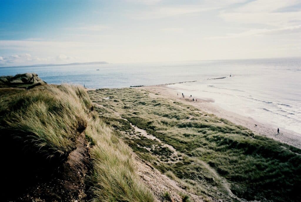
From the top of Hengistbury Head you can get a good view of Christchurch Harbour and the twin spits at the entrance to the Harbour and the salt marsh behind seen in the picture below. Groynes are visible again showing long-shore drift evidence and helping to maintain the spit. Clearly predicted sea-level rise due to global warming will put this area under considerable threat.

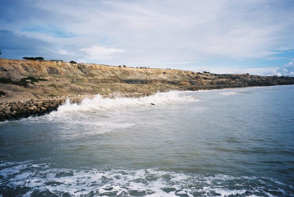
On the east side of Christchurch Harbour low cliffs of Barton Formation occur and these continue to the county border with Hampshire. These consist of sands and clays some which are very fossiliferous especially east of Naish Farm at Highcliffe. The two pictures below show the contrasting coastline where coastal protection is in place and where it is absent. The first picture is looking west from Highcliffe and you can see little evidence of the geology with the low cliffs well vegetated.
Again groynes are in place (rock armour in this case) to reduce long-shore drift and protect the coast. To the east, in the picture below, you can see the cliffs at NaishFarm eroding because there is no coastal protection. The chalet park at Naish Farm is clearly under threat and the chalets are moved away from the cliff edge as they come under threat. The cliff section is a Site of Special Scientific Interest (an SSSI)because of the importance of the fossils. This section is in Hampshire.
Alan Holiday
PLEASE SUPPORT US FOR JUST £2 A MONTH


