
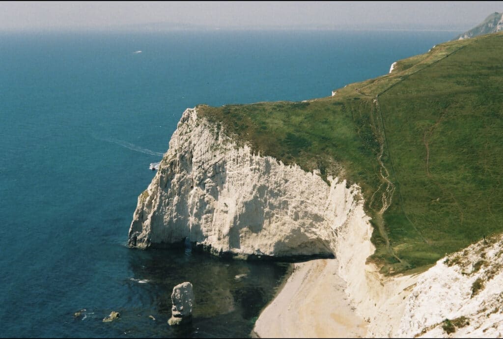
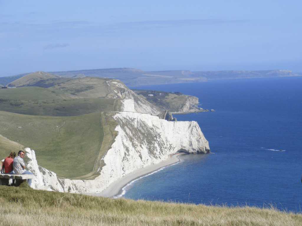
The next section of the coast is not particularly accessible and unless you have a canoe or some other water craft you can’t access the beach until you get west of White Nothe. However it is well worth the walk either from Lulworth or from the National Trust car park above Ringstead via the South West Coast Path. In places the terrain is quite testing with steep slopes but the views are often stunning. The picture below is of Bat’s Head looking west with evidence of the hilly terrain.Care needs to be taken because of the near vertical cliffs along this coastal section.
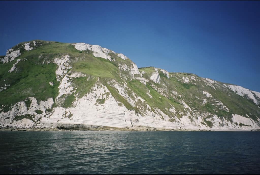
The whole of the coastal section to White Nothe is on the Chalk but therock layers vary in dip from vertical at Bat’s Head to a gentle dip of around 11o at White Nothe. The picture below shows White Nothe from the sea and illustrates the value of a boat trip along the coast. The shallow dip at White Nothe is more typical of the Dorset and East Devon World Heritage Site (Jurassic Coast) with a gentle dip from west to east so exposing progressively younger rocks as you go east. The steeper dips around Lulworth and Durdle Door are exceptional within the Jurassic Coast and are due to localised geological events associated with the Alpine earth movements 25-30 million years ago.
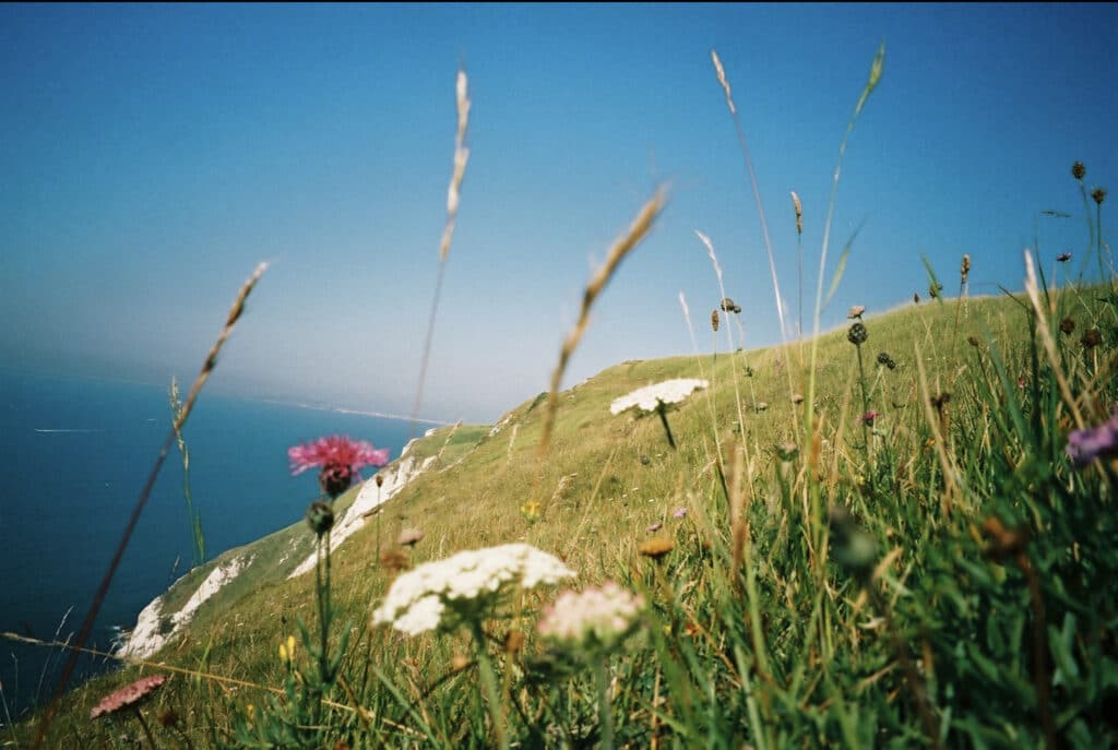
One of the things about walking this section of coast is the flora and fauna that has developed on the thin Chalk soil which technically is termed a rendzina. A rich flora of flowering plants has developed and this is particularly obvious in the June and July as seen in the picture below. The flowering plants attract a range of insects (butterflies, moths and beetles).
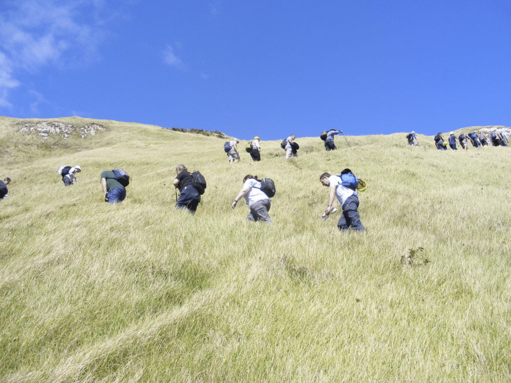
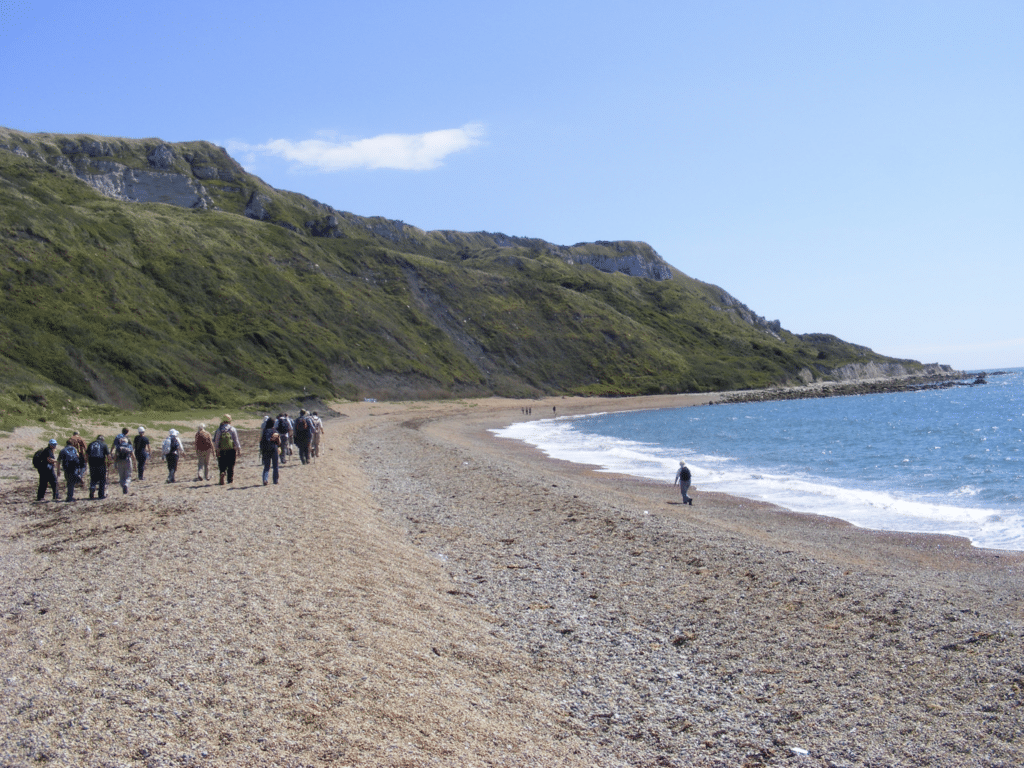
Once you reach White Nothe, easily recognised by the substantial cliff top former coastguard houses, you can continue on along the cliff top footpath to Ringstead or take the smugglers footpath down the cliff. This is rather steep and care is essential (see below).
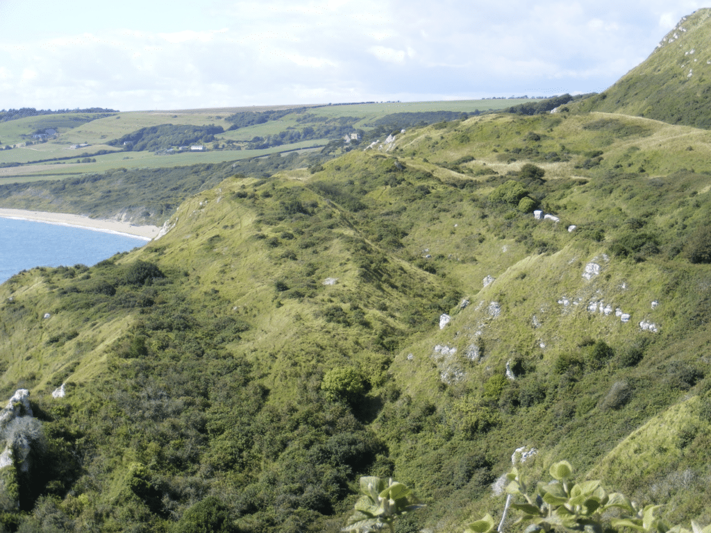
The views both to east and west are impressive and St Aldhelm’s Head can often be seen in the distance to the east with the top of Durdle Door just visible in the middle distance.
The landscape to the west of White Nothe is much affected by landslips because the Chalk is underlain by Kimmeridge Clay. This is because there is a major gap in the geological sequence of rocks with much of the Cretaceous missing. The picture below shows the terraces that have resulted from rotational slip type of mass-movement in the past. It is not moving much here at present as shown by the good vegetation cover but further west by Holworth House it is a different story.
The picture below shows part of Ringstead Bay and the Kimmeridge Clay exposed along the beach.
From the coast path it is possible to walk from White Nothe towards Ringstead and see more evidence of the landslips. In the picture below the Portland and Purbeck Beds rest on the Kimmeridge Clay giving an unstable cliff especially in wet weather.
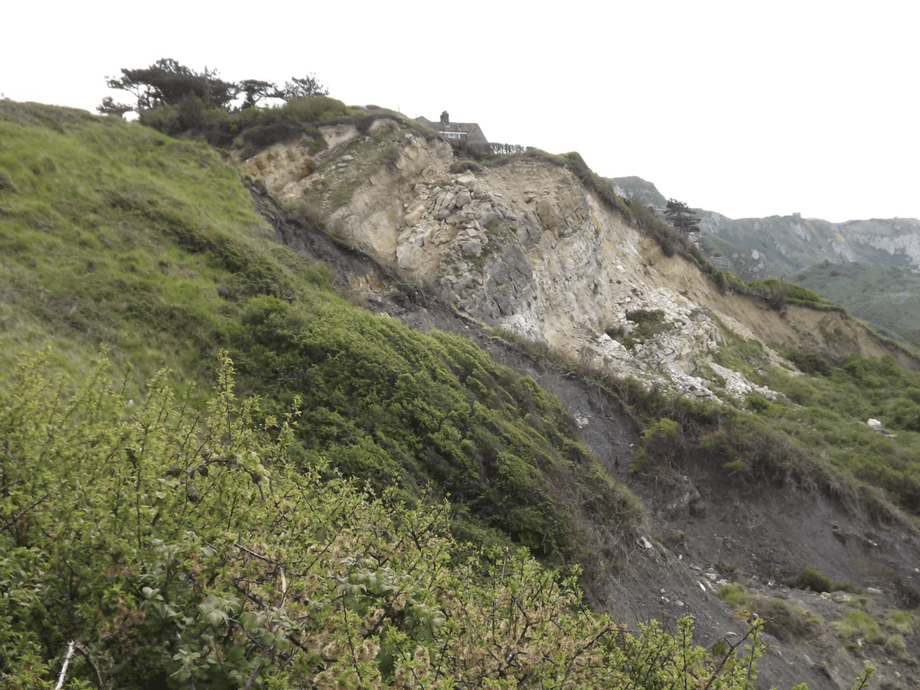
The picture above shows the Portland and Purbeck Beds dipping north(to the left) but at White Nothe the Chalk is dipping south, evidence of what geologists call an angular unconformity. This is due to earth movements taking place after one lot of strata are deposited and before the set of beds are deposited. Here much of the Cretaceous is missing – perhaps as much as 50 million years of rocks in this case.
Join us in helping to bring reality and decency back by SUBSCRIBING to our Youtube channel: https://www.youtube.com/channel/UCQ1Ll1ylCg8U19AhNl-NoTg SUPPORTING US where you can: Award Winning Independent Citizen Media Needs Your Help. PLEASE SUPPORT US FOR JUST £2 A MONTH https://dorseteye.com/donate/


