
It is possible to reach St Oswald’s Bay via the private road that leaves Lulworth Cove behind the Heritage Centre. Alternatively you can take the coastal footpath from the Heritage Centre car park or you can drive to the Durdle Door car park and walk down the footpath from there. There are fine views along the coast from the eastern end of St Oswald’s Bay at Dungy Head and there is a steep footpath down to the bay. The geology is similar to that at Lulworth Cove and Stair Hole but the strata (rock layers) are vertical or nearly so the width of the beds seen become narrower. The Wealden Beds also thin as you cross Dorset from Swanage (see article 2) to Worbarrow Bay (see article 6) to Lulworth Cove and finally Durdle Door Cove.
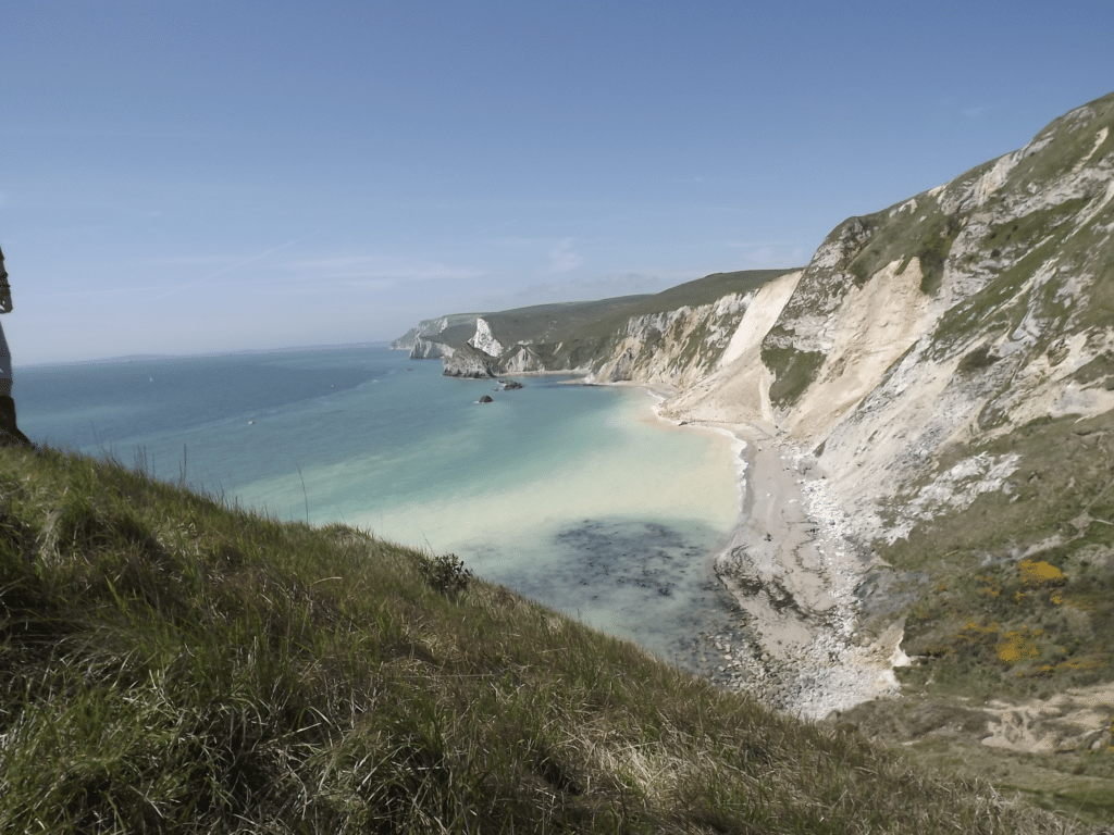
The picture above of St Oswald’s Bay was taken early in May 2013 following a massive landslip in the Chalk cliff seen in the middle distance. There is a plume of suspended Chalk in the sea. Despite the size of the slip, fortunately no one was caught up in it and surprisingly the Chalk debris was eroded away by early 2014 (gone before the storms in February 2014 though).
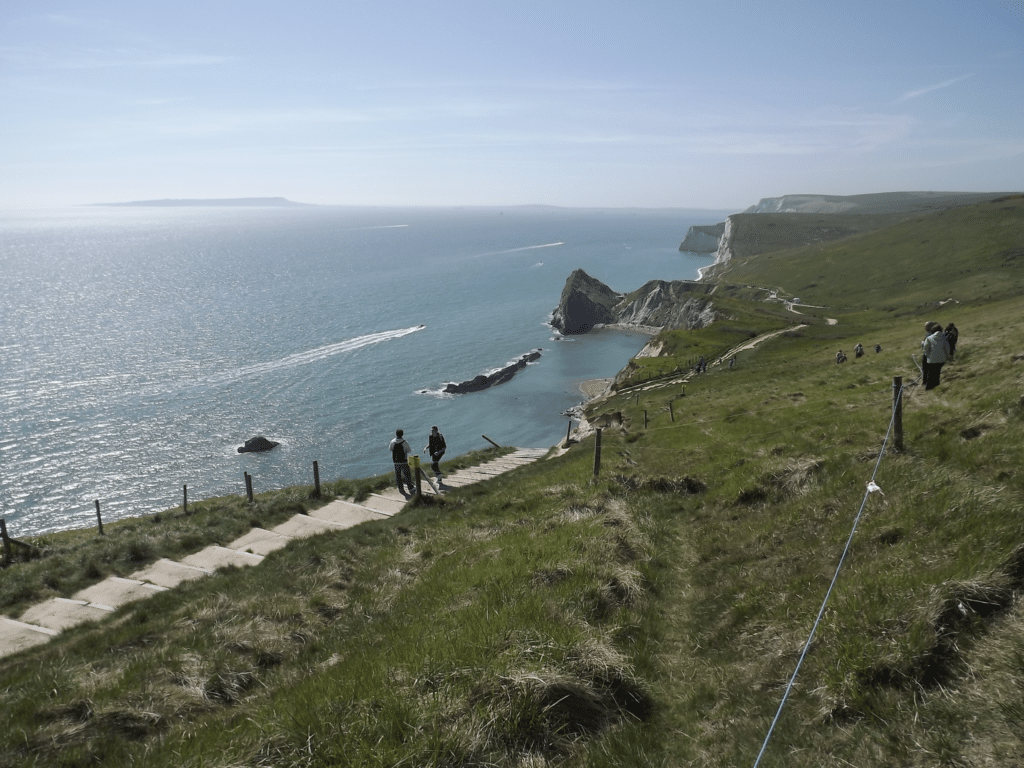
The picture below was also taken in May 2013 following the landslip and the size of the slip can be measured by the loss of the coast path which had to be redirected well inland. Despite the obvious hazard foolish people got over the safety ropes for a closer look! Portland and Wyke Hill, Weymouth can be seen in the distance.
If you attempt to walk along the beach from Dungy Head it is essential to do this with a low tide (spring tides on the new moon and full moon every fortnight).
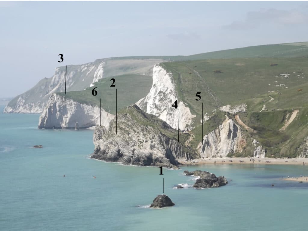
The picture below is a zoom shot from Dungy Head and shows the eroded stumps of Portland Limestone stacks (1) in the sea in the foreground with the Durdle Peninsula (Portland Limestone) (2) a little further west and then Bat’s Head with the beginnings of an arch and a small stack (3) (Chalk). The Purbeck Beds form the Man o’ War Cove east of Durdle Door (4) and the weaker Wealden Beds to the right (north) (5). The top of Durdle Door is just visible (6).
The picture above also helps to emphasise steepness of the slopes developed on the Chalk with deep dry valleys (including the curiously named Scratchy Bottom). The valleys were cut (at least in part) during the Pleistocene when the area was affected by extremely cold, tundra like, conditions (similar to Arctic Canada now). The ground was frozen (permafrost which made the ground impermeable i.e. water does not soak in) for long periods and summer melt of snow allowed streams to flow over the surface cutting the valleys. During the last 10,000 years the ground has thawed and the Chalk is now permeable and any water soaks in rather than flowing over the surface. The sea has also eroded the coast cutting the valleys back and leaving them ‘hanging’ above the beach. (Please note these are not hanging valleys in a glacial sense.)
The western end of St Oswald’s Bay is called Man o’ war Cove and is more easily reached by the footpath from the Durdle Door car park and the steps down to the beach. There is a fine view of the Purbeck Beds to the right (south) at the base of the steps where the strata can be seen to be vertical due to the earth movements which affected the area 25-30 million years ago. Differential erosion is apparent where the weaker clay beds have been eroded more easily that the stronger limestone beds. Some of the beds of limestone are fossiliferous with large numbers of oysters. The second picture below emphasises the difference in strength of the beds of rock which stick out into Man ‘o War Cove. The remnants of Portland Limestone can also be seen as stumps (partly eroded stacks). The scar of the 2013 landslip can also be easily seen. The cliff face to the right of the steps shows evidence of ripple marks formed when the sediment was deposited in the shallow water of the Purbeck lagoon 140-145 million years ago. See picture 6 in article 8 on the Fossil Forest which shows the environment which existed to help create the ripples and periodically the lagoon dried up.
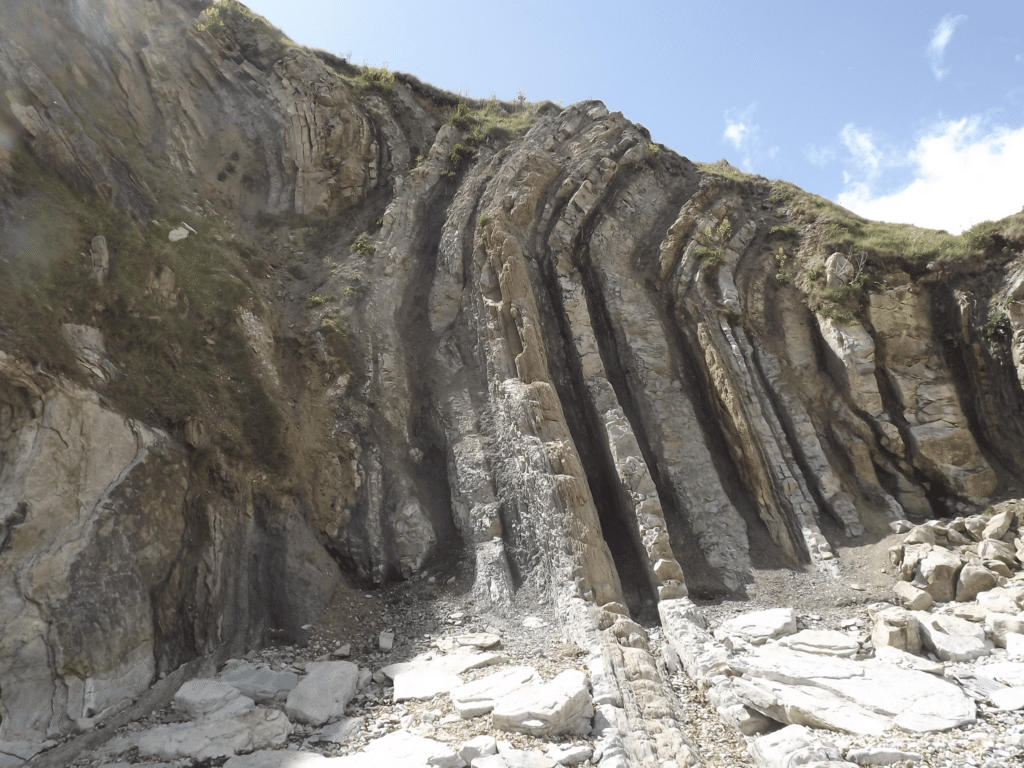
Approximate position of ripple marks on the rock face.
Join us in helping to bring reality and decency back by SUBSCRIBING to our Youtube channel: https://www.youtube.com/channel/UCQ1Ll1ylCg8U19AhNl-NoTg SUPPORTING US where you can: Award Winning Independent Citizen Media Needs Your Help. PLEASE SUPPORT US FOR JUST £2 A MONTH https://dorseteye.com/donate/


