
The beach west of Bran Point as far as Osmington Mills is covered with boulders so unless you are quite sure footed you might find it rather hard going. It is possible to return from Bran Point east along the beach around 400 m to a point where there is a foot path going from the beach to the South West Coast Path and then you can walk along the path to Osmington Mills.
Walking along the beach west from Bran Point the rocks are all Jurassic in age and from the Corallian around 150-155 million years old. Rock falls and clay flows are common especially in winter so it is advisable to walk this section with a low tide, preferably a spring tide on the new moon and full moon. It is advisable to keep back from the cliffs as much as possible. The picture below shows the view from Bran Point looking west. As you walk westward you will see the remains of a coal barge in shallow water that ran aground in 1927.
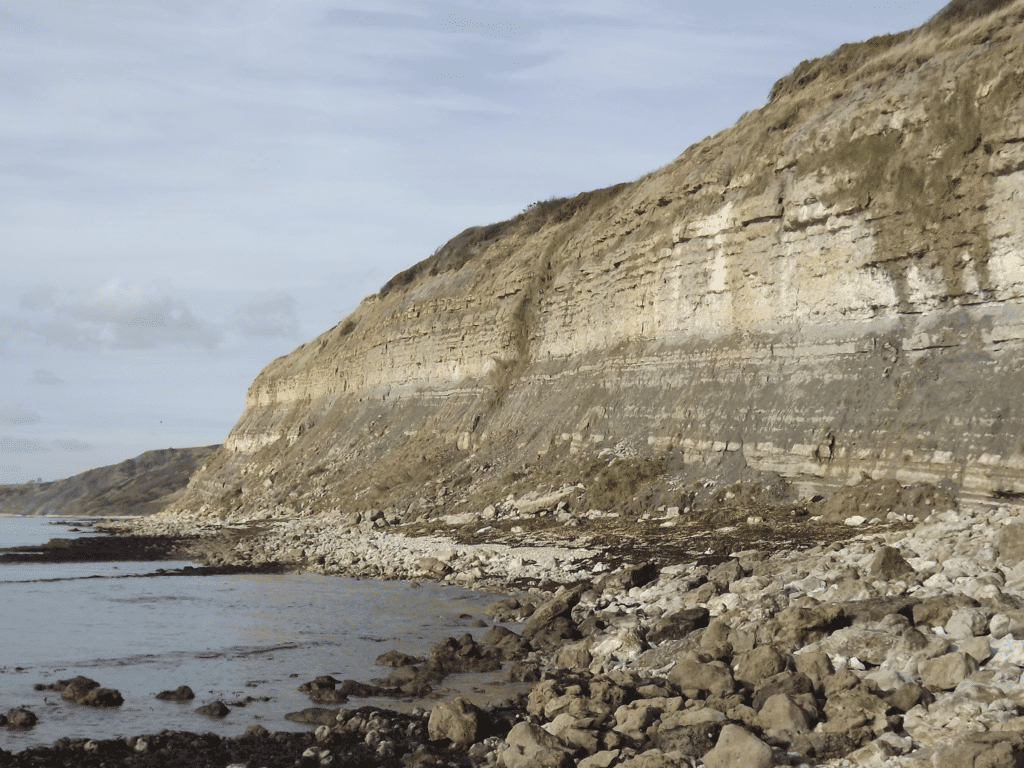
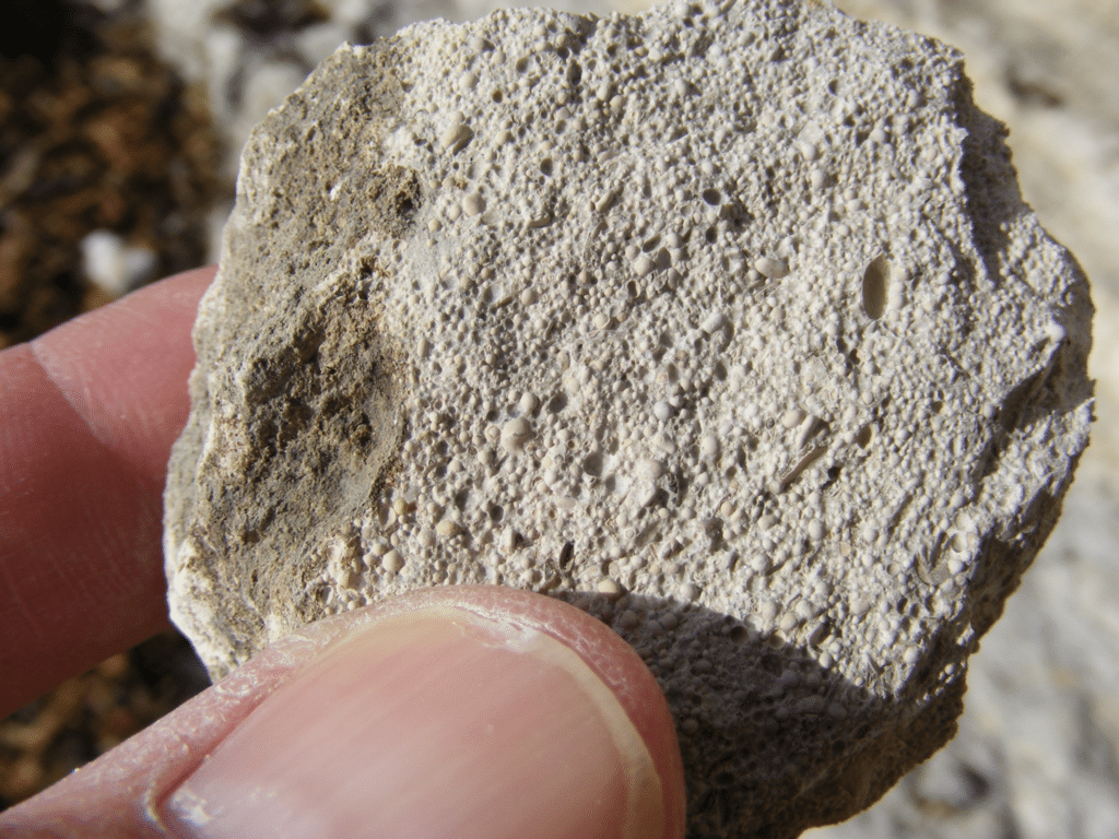
The strata are dipping gently to the east and one of the first things to notice is the large blocks of creamy coloured limestone. This is the Osmington Oolite. Oolitic limestone forms now in shallow tropical seas such as those you find around the Bahamas in the Caribbean and you need to imagine that south Dorset was like this 150 million years ago! The oolitic limestone is made of large numbers of small rounded grains (ooliths) and these are formed by sand grains or shell fragments getting a coating of lime mud precipitated from the sea water as the grain rolled around in the shallow water. The individual grains are around 0.5 mm in diameter.
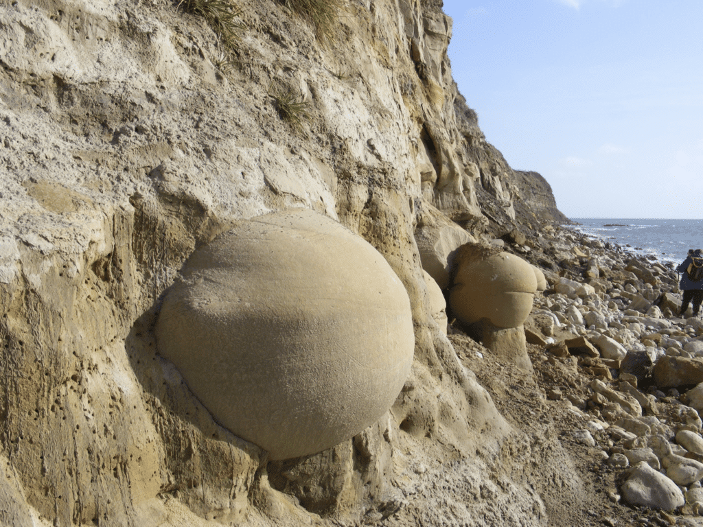
Further west large rounded boulders occur on the beach and others are protruding from the cliffs. The boulders are part of the Bencliff Grit and are well cemented carbonate rich sandstone. The surrounding sand is poorly cemented and the boulders are easily eroded from the cliff. However the boulders themselves are resistant and survive on the beach for long periods. Careful observation of the boulders, as seen in the picture below, shows evidence of cross-bedding. This indicates that the sediment forming the boulders was deposited in shallow water with strong current action.
Near-by it is possible to see dark coloured sand in the cliff face and this is due to the presence of an oily residue from a natural seep.
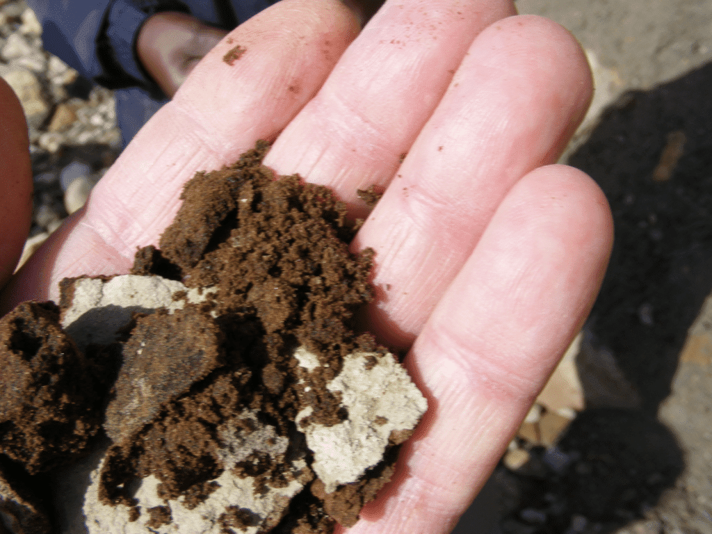
When this was seen in the 1930s it resulted in the beginnings of exploration for oil in Dorset. This eventually resulted in the finding of oil at Kimmeridge and later on at Wytch Farm. The oil and gas would have moved from a clay source rock to the sand of the Bencliff Grit (reservoir rock). However the erosion of the coast broke open the trap structure and the oil and gas escaped into the atmosphere leaving a tarry residue.
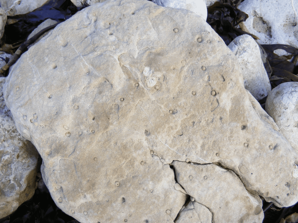
Trace fossils are very common in the rocks along this section. Trace fossils are tracks, trails or burrows where animals have been rather than the animals themselves. The creatures that created the traces were often non-vertebrates e.g. worms so they were not preserved but their burrows have been. The picture below is of some Skolithos burrows. This is a plan view, a section was seen in the last edition at Bran Point. Each burrow is 5-10 mm across. These again indicate how rich the marine environment was in much of Jurassic times.
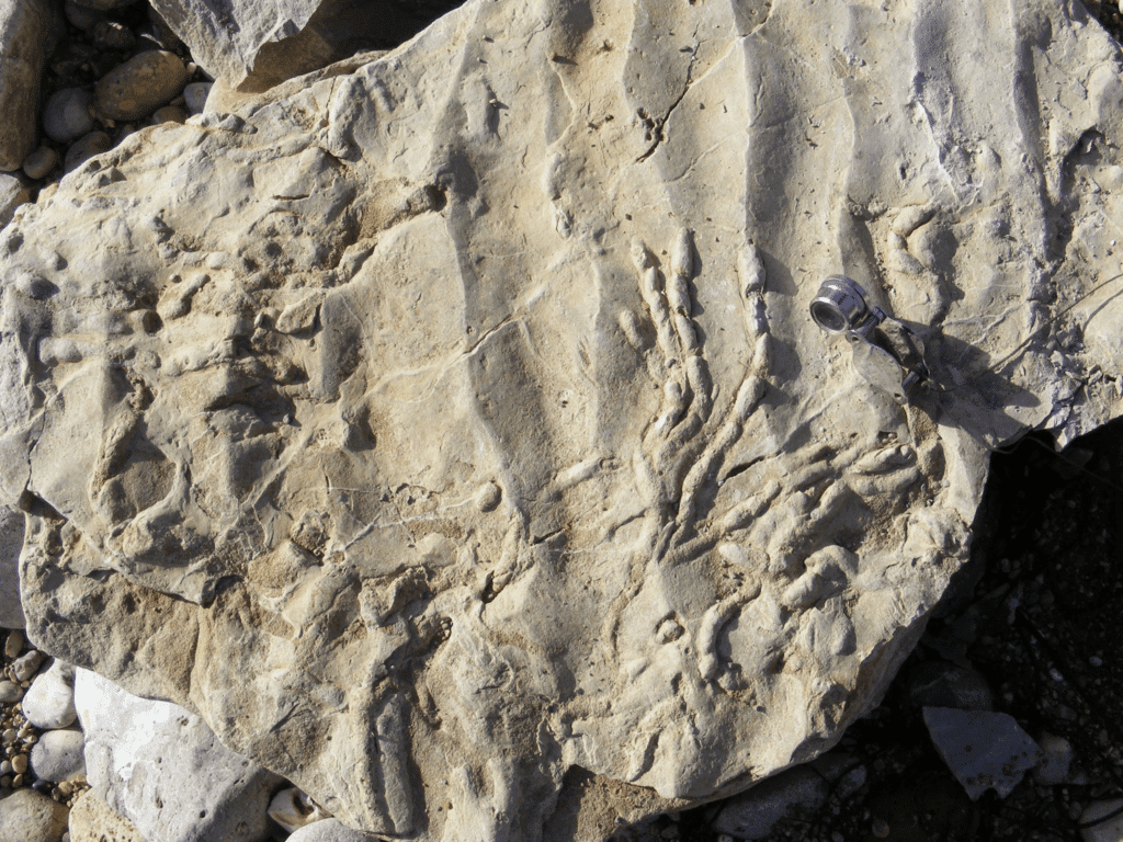
Another common feature in the rocks in this section either side of Osmington Mills is ripple marks which are formed on beaches now and can be preserved in the sedimentary rocks. The picture below shows some good symmetric ripples formed by wave action in shallow water. The ripples have survived as the sediment was carbonate rich which binds it together to form a rock now. The block also has another good example of trace fossil worm tubes. The hand lens in the picture used for scale is around 7cm in length.
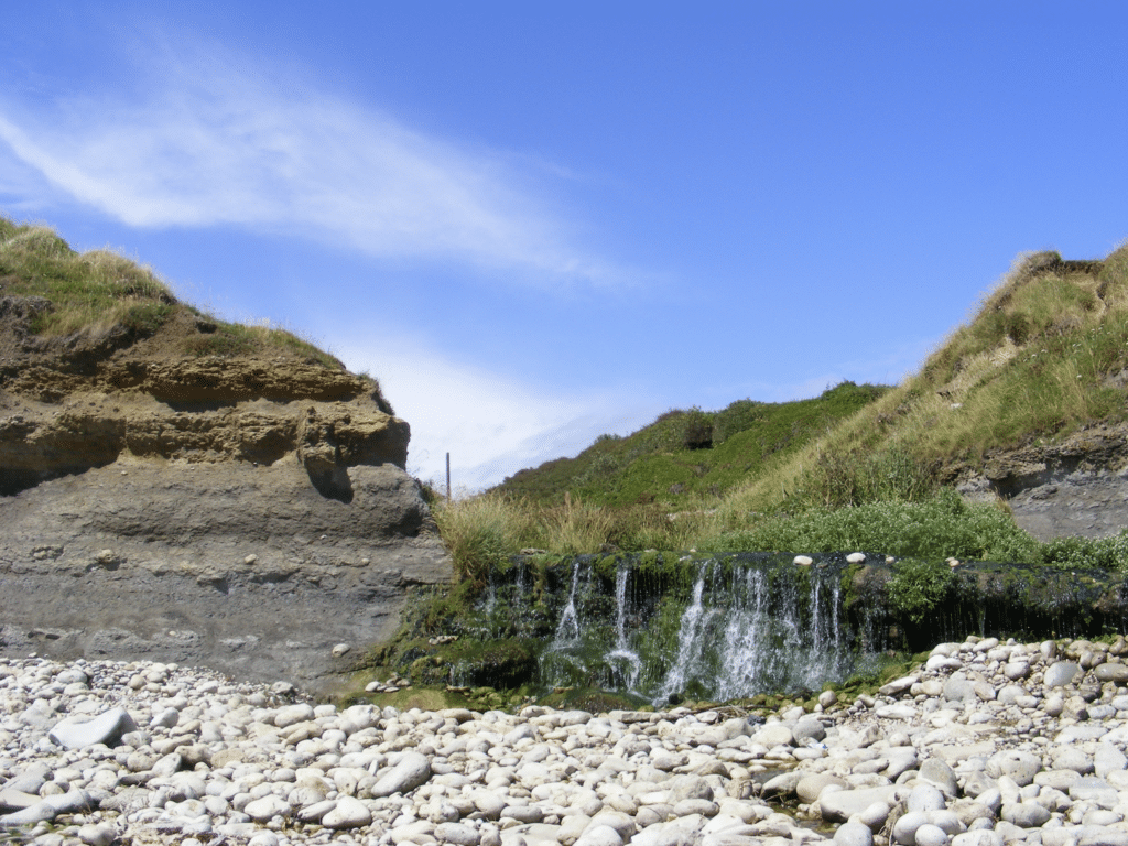
Just east of Osmington Mills a small stream reaches the beach and forms a low waterfall over a slightly harder sandstone bed, the Preston Grit.
The geology at Osmington Mills is complicated due to the effect of faulting, the most important fault being called the Picnic Inn Fault, after the former name for the Smugglers Inn.
The next edition looks at the beach section west of Osmington Mills.
Join us in helping to bring reality and decency back by SUBSCRIBING to our Youtube channel: https://www.youtube.com/channel/UCQ1Ll1ylCg8U19AhNl-NoTg SUPPORTING US where you can: Award Winning Independent Citizen Media Needs Your Help. PLEASE SUPPORT US FOR JUST £2 A MONTH https://dorseteye.com/donate/


